Rotating Headlines
Join this Weblog!
To become a Follower of this Weblog.
Click on the "Follow" link, underneath the list of current followers. You will be taken to an information panel where you may enter your personal details and other information. When completed, the title of this Weblog will appear in the Reading List on your Blogger Dashboard, and your Profile Picture will be displayed next to other Followers!
Followers to my Weblog!
Wednesday, January 10, 2007
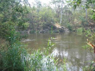
The Track to Blue Tongue Bend - Warrandyte State Park
This was a 4 km hike to Blue Tongue Blend, from the Jumping Creek Picnic Ground, Warrandyte State Park, following the steep, stony and rough fire access track up, over, and down the ridge top, through the bush.
This is the alternative access route which passes along the Stan Brae Track for a short distance.
This is only 25 km east of Melbourne!
I did this hike on January 9, 2007.
The reddish/brown/orange appearance in the images is smoke haze, from the bushfires in the Alpine areas east of Melbourne.
The full photo set is at
http://worldisround.com/articles/389727/index.html
Subscribe to:
Post Comments (Atom)
No comments:
Post a Comment