Rotating Headlines
Join this Weblog!
Click on the "Follow" link, underneath the list of current followers. You will be taken to an information panel where you may enter your personal details and other information. When completed, the title of this Weblog will appear in the Reading List on your Blogger Dashboard, and your Profile Picture will be displayed next to other Followers!
Followers to my Weblog!
Tuesday, November 13, 2012
The Tan Track reopened - Sherbrooke
A vital piece of Sherbrooke land has been restored and reopened to the public.
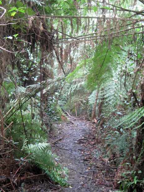
The 2.7 km Tan Track, which runs along Sherbrooke Rd linking Sherbrooke to Ferny Creek, is bustling with life again.
In 2011 and 2012, Parks Victoria staff restored the track and clearing it of weeds including English Ivy and holly.
The track, once part of the historic Burnham Beeches estate, became part of the Dandenong Ranges National Park in 1997, and has now been upgraded to allow cyclists, dog walkers, horse riders and bush walkers full access through the area.
The Track has also been extended to Hilton Rd in Ferny Creek. Parks Victoria maintains a 20m fuel break alongside the track.
I visited the Track on November 6, 2012, doing the Loop Circuit.
See a Slideshow of all of the Photos of my visit!
Friday, November 05, 2010
Sherbrooke Falls Circuit Hike
These photos were taken on October 30, 2010, in the Sherbrooke Forest, 40 km east of central Melbourne.
My 3 km return hike started at the Sherbrooke Picnic Ground, then along Sherbrooke Track and Ridge Track to the Falls.
The rain was incessant and the tracks had become running rivulets of mud!
The Falls were flowing strongly.
See all of the Photos!
Wednesday, July 21, 2010
Winter circuit hike in the Sherbrooke Forest
I visited the Sherbrooke Forest, 40 km east of central Melhourne, on Tuesday afternoon July 20, 2010.
My circuit hike started at the small car park at the junction of the Mt Dandenong Tourist Rd and Sherbrooke Rd, and I climbed up Moore Firebreak Track, reaching Edgebrook Track.
I continued to Hackett's Track, then along Monument Track, and back to the care, a distance of about 4 km.
Monument Track crosses the Sherbrooke Creek.
This hike was in magnificent tall forest and past fern gullies, with some colorful fungi along the way!
See all of the Photos of my visit!
Sunday, July 04, 2010
Nice winter colors in Sherbrooke Forest
On Saturday July 3, 2010, I ventured over to the Sherbrooke Forest, Dandenong Ranges National Park, 35 km east of central Melbourne.
It was a very cold and wet mid-winter day!
From thed Sherbrooke car park on Sherbrooke Rd, I followed the Sherbrooke Track, then Link Track, O'Donohou Track, and Hill Climb Track, reaching the Falls viewing platform.
My return was along Ridge Track and Sherbrooke Track, a total distance of about 4 km.
Many beautiful winter fungi had appeared, of all shapes, sizes and colors!
The tracks were very muddy, but that's expected!
The Sherbrooke Creek was flowing strongly, after recent heavy rains, and the Falls were good.
See all of the Photos of my trip, which include two historical images taken in year 1940.
Tuesday, June 22, 2010
Foden Track hike, Sherbrooke Forest
On June 19 2010 I went out to the Sherbrooke Forest, Dandenong Ranges National Park, 35 km east of Melbourne town.
My 3 km hike started and finished at the small car park off Grantulla Rd, in the Kallista district, at the junction of Foden Track. I followed this track to its end through beautiful ferns and tall timber, reaching Neumann's Track.
From there, I continued past Brendon's Corner forest, then into Wallaby Paddock, my turnaround point.
This is a lyrbebird habitat, and one was seen scratching in the bushland.
Wallaby Paddock was formerly a potato farm many years ago, dating to the 1940s, prior to its acquisition by Parks Victoria. Furrows still exist in the paddock!
See all of the Photos of my visit.
Monday, June 21, 2010
Exploring Monument Track, Sherbrooke Forest
On Wednesday June 16 2010 I ventured over to the Sherbrooke Forest, 30 km east of Melbourne town.
This was a horribly cold and bleak day, and from the small car park at the junction of Sherbooke Rd and the Mt Dandenong Tourist Rd, I followed Hackett Track.
This took me to Monument Track, and then on to Lloyd's Track and back to the car.
This was about 3 km total, through beautiful fern gullies and forest, with two crossings of the Sherbrook Creek.
Many colorful winter fungi had appeared!
See all of the Photos of my visit!
Sunday, June 06, 2010
Lyrebird Walk in early winter, Sherbrooke Forest
The Lyrebird Walk is in the Sherbrooke Forest, Dandenong Ranges National Park.
It's abour 3 km total, and runs from Grant's Picnic Ground on Monbulk Rd, to Cook's Corner on the Kallista-Emerald Rd.
I hiked this trail on Wednesday afternoon June 2, 2010, starting at Grant's, passing through beautiful lush fern forests, with the sounds of the lyrebirds nearby!
On reaching Cook's Corner, I followed the main road back to Grant's, where the usual multitudes of cockatoos, galahs, and parrots were waiting for their seeds!
See all of the Photos of my visit!
Friday, April 16, 2010
Sherbrooke Forest hike in early autumn
On Thursday April 15 2010 I was in the Sherbrooke Forest, Dandenong Ranges National Park, 35 km east of Melhourne town.
Leaving the car at the junction of Sherbrooke Rd and the Mt Dandenong tourist road, I did a circuit hike of about 3 km, following the Hackett, Monument, and Lloyd's Tracks.
This passed through beautiful tall timber and fern gullies, crossing the Sherbrooke Creek.
See all of the Photos of my visit!
Friday, April 09, 2010
Sherbrooke Falls in early autumn
![]() |
| On duty at Sherbrooke Picnic Ground! |
![]() |
| Sherbrooke Creek |
![]() |
| Sherbrooke Falls |
![]() |
| Sherbrooke Creek |
From the main car park on Sherbrooke Rd, I followed the Sherbrooke Track to the Falls, via Ridge Track. My return was along Hill Climb Track, then back on to Sherbrooke Track.
The Falls were only a trickle, due to the drought.
See all of the Photos which show the parrots at the car park, the Falls, beautiful ferns, tall timber, the Tracks, the Falls Viewing Bridge, and some candid camera shots!
Distance walked was about 3 km.
Tuesday, March 09, 2010
Sherbrooke Forest - Hardy Gully Walk


I continued up the steep hill to the site of the former farm, next to Wallaby Paddock, reaching the junction with Paddy Track, which leads to Jack the Miner. There is an increase in altitude from 350 m to 405 m on this track!
Huge black clouds formed overhead - lightning snd thunder - it started to rain - the heavens opened - I returned along Neumann's Track and Lyrebird Track which had turned into rivers of water and mud! I got soaked, dressed in a T-shirt, light track pants, and my Hawthorn Football Club spray jacket!
Got back to the Picnic Ground, still raining, to find the usual assemblage of cockatoos, parrots and galahs having their afternoon tea!
All this was about 4 km in total.
See all of the Photos of this trip!
Wednesday, September 09, 2009
Sherbrooke Forest - Circuit Hike


I visited the Sherbrooke Forest, 35 km east of the Melbourne CBD, on a wet and cold Monday Tuesday afternoon, September 8. 2009.
My 2 km circuit hike started opposite the Ferny Creek picnic ground, then on to Hackett Track, Monument Track, and along Lloyd's Track.
The Sherbrooke Creek was crossed twice.
Passing beautiful Mountain Ash and fern gullies, this short hike provides an excellent appreciation of the magnificent forest.
See all of the Photos of this visit!
Saturday, August 22, 2009
Two hikes in the Sherbooke Forest


On a cold and wet Friday afternoon, August 21, 2009, I went over to the Sherbrooke Forest, Dandenong Ranges NP, 35 km east of the Melbourne CBD. From Grant's Picnic Ground, Kallista.
I explored two interesting walking tracks - the Fern Tree Walk and the Margaret Lester Walk. These were about 3 km total, and well signposted.
The Margaret Lester Walk has information signs, with reproductions of historical photos dating back to the late 1800s, describing the development of the area.
Grant's Picnic Ground is a world-famous destination, where visitors may enjoy the company of hundreds of corinellas, galahs, cockatoos, and parrots, which like to be fed! Seeds can be purchased at the nearby kiosk.
The birds are very tame and certainly know when the next tour bus is about to arrive!
See the image of a young man lying on the ground, knocked over by the weight of many birds!
See all of the Photos of my visit, which include a young man lying on the ground, knocked over by the weight of many birds!
Wednesday, August 05, 2009
Lyrebirds in Sherbrooke Forest


I parked at Grant's Picnic Ground, on the Belgrave-Kalista Rd, the followed the Hardy Gully Track to Neumann Track. Passing Hardy's Creek, I continued along Neumann Track, with a steep climb to the large cleared area at the top, adjacent to Wallaby Flat. This land was formerly a potato farm in the 1940s, prior to its acquisition for incorporation into the National Park.
I was delighted to see a beautiful lyrebird just off the track!
From there I returned to the car, via the Lyrebird Track, through the magnificent forest and ferns.
I passed other hikers, who were also looking for lyrebirds!
My trip was about 4 km.
Back at Grant's Picnic Ground, the usual assemblage of cockatoos, galahs and parrots has gathered, waiting for seeds!
Please see the full set of Photos of my visit!
Tuesday, June 23, 2009
Pound Creek Track, Sherbrooke Forest


My visit was on Monday afternoon June 21, 2009, starting at the car park on the Belgrave-Monbulk Rd, opposite Limbscombe Break, at the back of the Tavern.
This took me along Hillclimb Track, then into Avard's Track, climbing steeply to the top of the hill opposite Sandell's Rd.
From there, I joined the Pound Creek Track, which descended through forest to a junction with Hillclimb Track, then back to the carpark. There is a rise in altitude on Avard's Track from 287 m to 333 m - the track is slippery, steep and rocky and care is needed in damp weather.
See the full set of Photos of my visit.
Thursday, June 11, 2009
Winter walk to Long Bridge, Sherbrooke Forest

My route followed Wattle Track to the historical Long Bridge over Sherbrooke Creek, then along Sherbrooke Track to the Sherbrooke Picnic Ground, then into Lloyd's Track and back to the car.
My objective was to sight and identify Fungi, which appear during winter in the Forest, and I was not disappointed!
I passed other walkers, one of whom was well protected from the rain under a large blue umbrella. Two other walkers were preparing hot soup at the Nicholas Gardens carpark with a small portable camping stove.
See the full set of Photos of my visit!
Tuesday, June 09, 2009
Lyrebird Walk in the Sherbrooke Forest

From a starting point at Cooke's Corner, on Grantulla Rd, I went along the Lyrebird Walk, through splendid forest and fern gullies, reaching Grant's Picnic Ground.
From there, I continued along the foot-track next to Grantulla Rd, arriving back at Cooke's Corner, a total distance of about 3 km.
Sadly, no lyrebirds were seen!
This track is steep in sections, with a change in altitude from 420 m at Cook's Corner, to 350 m at the creek.
Care is needed in wet weather.
See the full set of Photos.
Thursday, June 04, 2009
Wallaby Paddock hike, Sherbrooke Forest

It is the site of a former potato farm of the 1940s.
It is reached from Grant's Picnic Ground, on the Belgrave-Kallista Rd, following the Hardy Gully Walking Track, then Neumann Track.
The route passes through lush ferns and tall mountain ash, through mainly regrowth forest.
I discovered a lyrebird and two Eastern Grey Kangaroos at Wallaby Paddock! At Grant's Picnic Ground there were the usual assemblages of parrots and cockatoos, having their afternoon snack of seeds purchased by visitors at the Kiosk!
There were also two white Long Billed Corinellas amongst the multitudes, not often seen here!
Many nice colored fungi had appeared along the tracks.
My visit was on Wednesday afternoon June 3. 2009, and the total walking distance was 4 km.
See all of the Photos of my visit!
Wednesday, May 06, 2009
A Hike in the Sherbrooke Forest


These creatures are very shy, and are only rarely seen, occasionally emerging from the forest and dashing quickly across the walking tracks.
I visited this beautiful forest on May 4, 2009, exploring the Monument and Lloyd Tracks, a distance of about 4 km, starting and finishing at a small car park on Sherbrooke Rd.
My journey took me through tall timber, over footbridges and a creek, and past magnificent fern gullies.
The day was overcast, cold, foggy, and very misty and mysterious in the dark forest. Sadly, no lyrebirds were seen!
See the complete set of Photos of my triup!
Wednesday, April 29, 2009
Sherbrooke Forest Trails

My base was Grant's Picnic Ground, whence I explored the Margaret Lester Forest Walk, Coles Ridge Rd, then along Tregallas Track, and back via the Bleakley Track.
This was about 3 km in total, on a bleak and wintry day!
Tregallas Track is named after Jack Tregallas, an early naturalist photographer, who lived in a small log hut until his death in 1938. His main interest was the study of the habits of lyrebirds.
Grant's Picnic Ground always has large communities of white cockatoos, galahs, and parrots, who congregate there for seeds, which may be purchased from the Kiosk.
The Margaret Lester Forest Walk passes through an old logging area, and interpretative signs, featuring reproductions of old photographs, are placed at vantage points describing the history of the region.
See the full set of Photos of my visit, which include images of the intepretative signs on the Margaret Lester Walk.