Rotating Headlines
Join this Weblog!
To become a Follower of this Weblog.
Click on the "Follow" link, underneath the list of current followers. You will be taken to an information panel where you may enter your personal details and other information. When completed, the title of this Weblog will appear in the Reading List on your Blogger Dashboard, and your Profile Picture will be displayed next to other Followers!
Followers to my Weblog!
Showing posts with label warburton rail trail. Show all posts
Monday, March 25, 2013
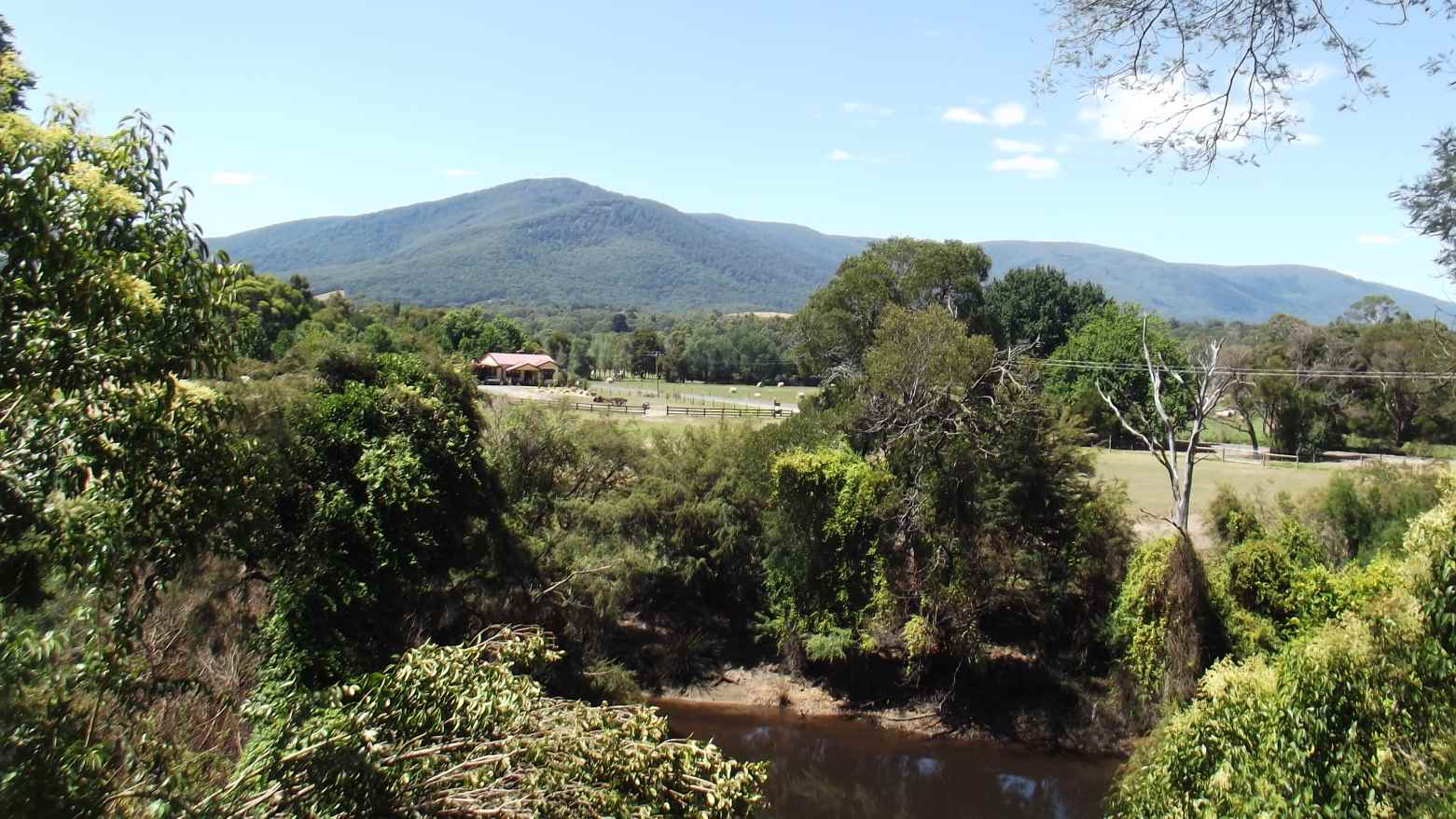
Warburton Rail Trail, between Millgrove and Warburton
Pix taken on March 24 2013 along the Warburton Rail Trail, between Millgrove and Warburton, a hike of some 4 km (return).
Good views of the adjacant Yarra River, and to Mts Donna Buang, Victoria, and Ben Cairn.
Click here to see all of the Photos of my visit!
Labels:
millgrove,
warburton rail trail
Location:
Millgrove VIC 3799, Australia
Monday, February 04, 2013
Warburton Rail Trail. - west from Killara
This was a 3 km return hike from the trail crossing at Sunnyside Rd (Killara station) to the Chandler Rd crossing (near Seville).
Lots of action - cyclists, hikers, prams, and hounds!
Nice views to the Ranges, across the farms.
Click here to see all of the Photos of my visit.
Labels:
killara,
seville,
warburton rail trail
Location:
Seville VIC 3139, Australia
Monday, January 28, 2013
Warburton Rail Trail - Yarra Junction to Wesburn
Pix of January 26, 2013, along the Warburton Rail Trail, on a 4 km (return) hike from Yarra Junction to Wesburn.
Good views to the Ranges - plenty of pedestrian and cycling activity, to commemorate Australia Day!
The train picture shows the goods service near Yarra Junction, just prior to the closure of the line.
Click here to see the complete set of Photos of my visit!
Tuesday, January 22, 2013
Warburton Rail Trail - Killara
Most of these pix were taken on January 21, 2013, along the Warburton
Rail Trail, 4 km (return) hike starting at the former Killara Station,
travelling east towards Woori Yallock.
Excellent views towards Mt Donna Buang.
The Trail passes vineyards and farms.
I've
included some heritage photos showing a Train at the Station in 1905,
the Station in 1964, and a group of scouts on the station in 1939. No
sign of the scouts now!
The Station had a siding, and one island platform, where produce from nearby farms would be unloaded for the trip to Melbourne.
This siding is now the small picnic area.
The Station can be reached from Sunnyside Rd, then along Kylie Lane, which was the original access route for horses and carts, later motorized transport.
The Station and Line closed in 1965.
Opposite the station is a sole metal telegraph pole, used for signalling along the Line. See Photo!
About 1 km east of the Station is a distance marker, the half-way point between Lilydale and Warbuton, showing 20 km in each direction. There is also an Emergency Marker at this point, provided by Yarra Ranges Shire.
See the complete set of Photos of my visit!
| The Station today |
Excellent views towards Mt Donna Buang.
The Trail passes vineyards and farms.
| Mt Donna Buang |
| The 20 km marker |
![]() |
| Scouts on Station in 1939 |
The Station had a siding, and one island platform, where produce from nearby farms would be unloaded for the trip to Melbourne.
![]() |
| Station 1964 |
The Station can be reached from Sunnyside Rd, then along Kylie Lane, which was the original access route for horses and carts, later motorized transport.
The Station and Line closed in 1965.
Opposite the station is a sole metal telegraph pole, used for signalling along the Line. See Photo!
| The surviving telegraph pole |
About 1 km east of the Station is a distance marker, the half-way point between Lilydale and Warbuton, showing 20 km in each direction. There is also an Emergency Marker at this point, provided by Yarra Ranges Shire.
| The author on the Station platform! Where are you, scouts? !! |
See the complete set of Photos of my visit!
Labels:
killara,
warburton rail trail
Location:
Woori Yallock VIC, Australia
Friday, January 18, 2013
Warburton Rail Trail - Wandin
These pix were taken on January 8 2012 along the Warburton Rail Trail, on a 4 km hike starting at Wandin Station.
This was on a very hot day, about 35 degrees on the Trail!
The Railway from Lilydale to Warburton opened in 1901 and closed in 1965.
See all of the Photos of my visit!
Labels:
wandin,
warburton rail trail
Location:
Wandin North VIC 3139, Australia
Wednesday, January 16, 2013
Warburton Rail Trail - Launching Place
These pix were taken on January 14 2012 on the Warburton Rail Trail, on a 4 km (return) hike starting at Launching Place.
Points of interest included splendid views to the Yarra Ranges, a farm with various animals and birds, And three bridges over creeks.
Hot day, millions of biting flies.
See all of the Photos of my visit!
Points of interest included splendid views to the Yarra Ranges, a farm with various animals and birds, And three bridges over creeks.
Hot day, millions of biting flies.
See all of the Photos of my visit!
Friday, January 11, 2013
Warburton Rail Trail, at Woori Yallock
These pix were taken on January 6 2013 on the Warburton Rail Trail, at Woori Yallock, 56 km east of Melbourne.
This was a 4 km return hike, starting at the former Woori Yallock Railway Station (closed in 1965).
Some excellent views to the Yarra Ranges.
See all of the Photos of my visit!
This was a 4 km return hike, starting at the former Woori Yallock Railway Station (closed in 1965).
Some excellent views to the Yarra Ranges.
See all of the Photos of my visit!
Subscribe to:
Posts (Atom)