On Friday March 26. 2010, I visited the remote Yarra Brae Section of the Warrandyte State Park, 20 km east of the Melbourne CBD. I completed an 8 km return hike along the gated Market Garden and Lucerne Paddock Tracks, both being fire management tracks, starting and finishing at the Clifford Activity Centre, reached from Clifford Drive, off Jumping Creek Rd.
The State government purchased the Stane Brae and Yarra Brae river frontages in 1982 and both parcels of land were incorporated into the park in 1987.
This is one of the best long walks in the Park, following the ridge top, with excellent views easterly over the Yarra Gorge towards the Yarra Ranges, to the Dandsenong Ranges, and the Mt Lofty section of the Park.
Market Garden Track starts at the Clifford Activity Centre. Just north of signed Scout Track is a short side-track leading up to a large cleared summit space on a hilltop - there are good views from here to the Kinglake Ranges and hills around Kangaroo Ground, and across neighbouring farms, grazing properties, and equestrian centres.
Market Garden Track then descends to a large clearing next to the Yarra River, believed to be the site of an early farm. This is a Water Point for fire management purposes. Immediately opposite this point is the small municipality "Bend of Islands", an Environmental Living Zone.
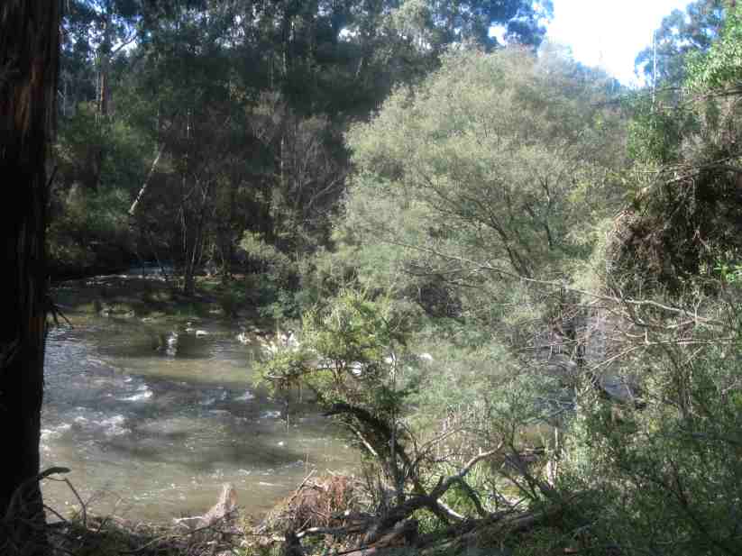
From this spot, a gate marks the start of unsigned Lucerne Paddock Track, which follows the river, until another large cleared area is reached. This is another Water Point for fire protection purposes. It is assumed that this was the original Lucerne Paddock.
Here there are the remains of an old building, now only concrete foundations and a crumbling concrete tank and roof tiles.
From there, it was a 3.5 km trudge back to the start, mindful that there is an increase in altitude fromn 50 m to 130 m!
HISTORICAL NOTES
This area was originally known as the Yarra Brae Farm, a huge pastoral holding of about 400 Hectares, which is dated to the early 1920s. Most of this was bushland/forest, with about 8 km frontage to the Yarra River.
Large sections of this land were cleared in the 1920s and 1930s for timber, and the area was then opened up for agricultural purposes, mainly orchards and grazing.
In 1940, the property was auctioned, which by that time comprised about 250 Ha of grassland, and 150 Ha of timber.
Now, the Yarra Brae Riding Centre occupies about 100 Ha of the former Farmsite. The perimeter of the Centre adjoins Market Garden Track and Lucerne Paddock Track, now within the State Park.
During the years of World War 2, part of the area was used for military training excercise.
Lord Clifford became the owner of the farm in 1942. In 1948 he offered the use of approximately 150 Ha to Scouts Australia for the 3rd Pan Pacific Jamboree. Referred to as "Yarra Brae Jamboree", it was the first post-war international scout gathering and attracted 11,000 scouts and scouters from around the world.
Again in 1955, Lord Clifford offered the property to Scouts Australia for the 5th Pan Pacific Jamboree. Known this time as the "Clifford Park Jamboree" and remembered as the "Mudboree", the event attracted 16,000 participants from 25 countries.
In 1962, it was the location for the 7th World Rover Moot the first world scouting event ever to be held in Australia. The World Rover Moot was attended by more than 1000 Rover Scouts from across the globe.
Following the death of the owner Lord Clifford, Yarra Brae Farm was sold at auction in 1967. The new owners continued to allow scouts the continuing use of the area surrounding the old parade ground along the river.
After purchase by Scouts Australia in 1983, the site was used mainly at weekends as a scout camping and activity venue. In 1995, in an effort to be more proactive in the community the Committee of Management decided to sponsor a new organisation, The Friends of Clifford Park, and open the property not just to scouts, but to the wider public as the "Clifford Park Activity Centre".
The first subdivision of the farm was approved in 1983 and Scouts Australia, Victorian Branch was able to purchase freehold the present 20 Ha acre site which became known as "Clifford Park".
At around the same time, the Victorian Government resumed the whole Yarra River frontage to become part of the Warrandyte State Park,
With the support of Manningham City Council, both Federal and State governments and TAFE institutes at Box Hill, Swinburne and Holmesglen, the Friends have helped transform the park into a place of adventure, excitement and passive recreation -- a centre that can accommodate the needs of both scouting and non-scouting communities and one of which the whole community can justly be proud.
With full catering being available, Clifford Park also offers seminar facilities for government, local government, education and corporate entities who wish to conduct programs or staff development activities.
All developments to this stage have been carried out according to a master plan approved by the City of Manningham, which emphasizes the values of environment, activities for youth and scouting heritage.
There is comprehensive information about Clfford Park at the following Website, to which acknowledgement is given for some of the historical background in this article.
http://www.vicscouts.asn.au/CliffordPark/index.html
Members of the public may explore it by foot at any time. There is access through it to the Yarra River precinct at the northern boundary.
See all of the Photos of my visit, which include some historical images of Yarra Brae and Clifford Park, dating back to the 1930s.