An open watercourse (known as the Forest Hill Drain), marks the western boundary, which passes beneath Canty Rd and ends near the Nunawading Aqualink in the Forest Hill Reserve.
A gravelled pathway continues northeasterly past the northern boundary of the Reserve - this follows the alignment of the drain which is now underground in large pipes.The drain was originally a creek which started near Rook's Rd.
Residential development started around 1962 when the remaining orchards were subdivided and converted to housing blocks.
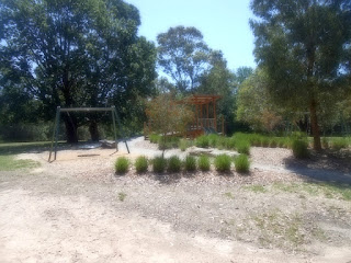
The Dale features a childrens' playground and rustic timber seats.
A footpath crosses the drain and leads up a series of steps to Bristow Drive .
There is street parking off Felicia Grove, which starts at Canty Rd. My visit was on December 12, 2018.
 |
| Aerial photo of the land in 1945 with Mt Pleasant Rd at the left. |


No comments:
Post a Comment