Rotating Headlines from this Weblog! Click to view Post!

Rotating Headlines

Join this Weblog!

To become a Follower of this Weblog.
Click on the "Follow" link, underneath the list of current followers. You will be taken to an information panel where you may enter your personal details and other information. When completed, the title of this Weblog will appear in the Reading List on your Blogger Dashboard, and your Profile Picture will be displayed next to other Followers!

Followers to my Weblog!

Showing posts with label Maroondah Reservoir. Show all posts

Thursday, November 28, 2013

Maroondah Reservoir in late Spring


These pix were  taken on November 27y 2013 at the Maroondah Reservoir, Healesville.


Click here to see an Album of all of the Photos of my visit, in Static or Slideshow format!

Click here to see a map of the route, with imaging!

Tuesday, March 13, 2012

Graceburn Weir revisited - Healesville


The Graceburn Weir and Aqueduct were built in 1892, and are part of Melbourn's water catchment and supply network. They are located east of Healesville, 80 km east of Melbourne.

Walkers are permitted to use the management track, 3 km return, which starts at the main gate at the Maroondah Highway and continues to the Weir.

The Government proposes to close public access to the Weir, to minimise contamination by visitors, and to set up a new Track in the area.

Much of the forest surrounding the Weir and access track was destroyed in the February 2009 fires, and there has been spectacular regrowth since. However, the blackened stumps and trunks which remain are a grim reminder of the disaster.

I visited the Weir on March 11, 2012, an annual trip!

A picnic area and facilities were once located near the Weir - sections of this remained until 2007, but have now been removed. Early photos show visitors standing on the Weir infrastructure, but such access is no longer permitted.

See all of the Photos of my visit, and my YouTube video!

Friday, January 20, 2012

Exploring the Maroondah Reservoir Park in summer


These pix were taken on January 18, 2012, in the Maroondah Reservoir Park, 60 km east of Melbourne.

They show the flora, scenery, and environment on a 4 km hike in the Maroondah Forest, along the Dam Wall, down the Rose Stairway, around the Lily Pond, the Flower Clock, and the Spillway.

See all of the Photos of my visit, and my YouTube video!

You might like to check out my Maroondah Reservoir Pictorial Heritage Project.

Wednesday, April 27, 2011

Maroondah Reservoir Pictorial Heritage

Hi there!
 
I am pleased to announce the publication of my comprehensive Maroondah Reservoir Pictorial Heritage editorial research project.

I'm inviting you to check out this special project, which is now available on-line at
http://bpadula.tripod.com/maroondah

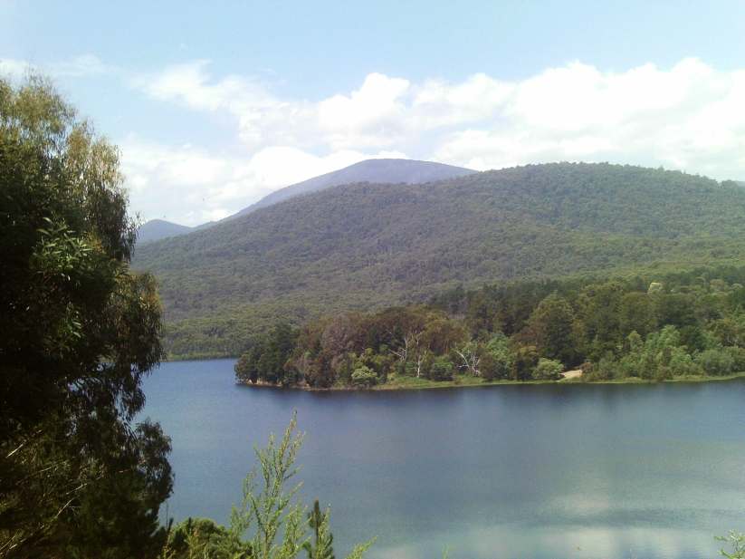
Its articles, stories, images, maps, engravings and videos describe the development and evolution of this magnificent reservoir and its beautiful surroundings, 65 km east of Melbourne, just past the town of Healesville, in the years 1862 until 2011.

Extensive use has been made of information sourced to old Victorian newspapers, using the National Library of Australia's on-line digitization system.

I have always maintained a strong and continuing interest in the Reservoir and its nearby areas, from my first trip there in October 1957.

The Maroondah Forest Park has also been a good location for HF radio monitoring in recent years.

I have included several images of that first visit scanned from my original 35 mm colored slides.

The project is arranged in these Chapters:

  • Historical Timeline
  • The First Weirs 1878-1891
  • Construction 1915 to 1929
  • The Yarra Track
  • The Blacks' Spur
  • Heritage Pictures 1872 to 1926
  • Images of 1957
  • Gallery of 2011
  • Interesting Features
  • Maroondah Reservoir Park
  • Walking Tracks
  • Present day Maps
  • Old Maps
  • References and Bibliography

I would welcome your feedback and reactions on this Project - there is a Guest Book at the site.

I hope you enjoy your tour through time of the Reservoir since its beginnings way back in 1865 - now one of Victoria's most famous tourist attractions within a short distance of Melbourne.

Monday, December 06, 2010

Henderson Hill ascent, Healesville


These pix were taken on Sunday afternoon December 5, 2010.

They show the scenery, environment, and flora on a 4 km (return) hike to the summit of Henderson Hill, which overlooks the Maroondah Reservoir.

My route was from the Henderson picnic ground at the base of the Reservoir, following the Donnelley's Weir Track.

There was an increase in altitude from 120m to 250m - the track is steep and stony in sections, and there is a seat at the summit!

There are nice views towards the Yarra Ranges through tall timber, much of which was destroyed in the February 2009 fires, but now regenerating.

See all of the Photos of my trip!

Monday, April 19, 2010

Maroondah Reservoir Park in early autumn

I visited the beautiful Maroondah Reservoir Park on Saturday afternoon April 17, 2010, 70 km east of Melbourne.

From the main car park/Henderson's picnic area, I hiked up the Maroondah Forest Trail, reaching the Lookout.

The views across the Dam, and to the surrounding mountains, were spectacular!

I descended to the top of the Spillway, then along the top of the Dam Wall, reaching the quaint Rotunda adjacent to the display boards of the history and construction of the Dam.

From there I walked down the paved terraced Rose Stairway to the Rose Garden, then to the Spillway Observation Area, around the colorful Lily Pond and Fern Grotto, then back to the car.

The present-day Watt's River starts at the outflow of the Spillway - the Dam was built over the original Watt's River in the 1920s.

This circuit hike was about 3 km in total.

The Dam from the Lookout

The Dam fromn the Dam Wall

The Spillway
See all of the Photos of my visit!