Rotating Headlines
Join this Weblog!
To become a Follower of this Weblog.
Click on the "Follow" link, underneath the list of current followers. You will be taken to an information panel where you may enter your personal details and other information. When completed, the title of this Weblog will appear in the Reading List on your Blogger Dashboard, and your Profile Picture will be displayed next to other Followers!
Followers to my Weblog!
Showing posts with label healesville. Show all posts
Wednesday, November 04, 2015
Mt St Leonards Walking Track - Donnellys Weir
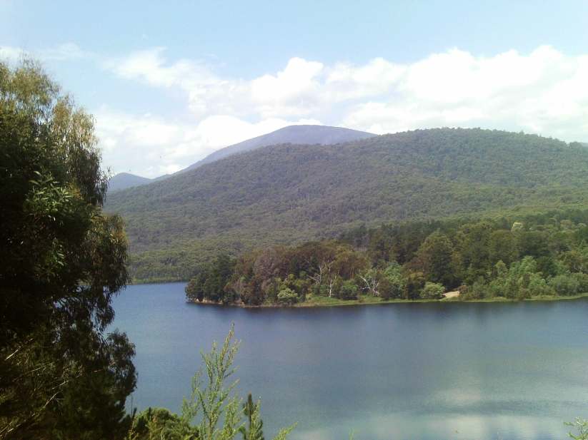
A 4 km hike on November 3, 2015, along the southern section of the Mt St Leonads Walking Track, north of Healesville. The start and finish was at Donnelly's Weir. The change in altitude was from 100 m to 320 m.
Wednesday, June 13, 2012
Mt St Leonard in winter
These pix were taken on June 12 2012 at Mt St Leonard, 70 km east of Melbourne, overlooking the town of Healesville.
They show the scenery and environment on a 3 km return hike to the summit, from Monda Rd, with spectacular panoramas across the Yarra Valley to Melbourne and beyond.
Some images have been included of the large communications towers on the summit.
|
It is not commonly known, but in 1945 the Australian Army carried out experimental test transmissions from the summit to assess high frequency radio coverage, using the No.10 wireless set.
Sadly, much of the surrounding forest is being decimated by logging activity.
See a Slideshow with text and music, of my visit
Wednesday, April 25, 2012
An autumn hike in the Maroondah Reservoir Parkrk
Pix taken April 21 2012 in the Maroondah Reservoir Park, 60 km east of Melbourne.
This was a circuit hike of 4 km, atarting at Donnelley's Weir Rd, then along gated Management Rd 17, to the historical Sawpit Creek Weir, along the Maroondah Aqueduct Track, and then back to home base along Donnelleys Weir Rd.
See all of the Photos!
Monday, March 26, 2012
6th Annual Mountain District Car and Bike Show, March 25 2012.
These pix were taken at the 6th Annual Mountain District Car and Bike Show, March 25 2012.
The event was held at the Healesville Showgrounds, Don Rd, at the base of Mt Riddell, 70 km east of Melbourne, and was hosted by the 60s American Muscle Car Club.
All proceeds went to to charity - admission was $5. On display were hot rods, classic custom and vintage cars, classic and custom Bikes and utes.
Early model Holdens were proudly on exhibition, meticulously restored and maintained, in full working order.
Many organizations had stalls, some selling beautifully crafted models of vintage cars.
Hundreds of visitors there!
A Guitar Pop Band was playing 1960s songs from a truck at huge volume, which could be heard all over the town!
A very good show!
The event was held at the Healesville Showgrounds, Don Rd, at the base of Mt Riddell, 70 km east of Melbourne, and was hosted by the 60s American Muscle Car Club.
All proceeds went to to charity - admission was $5. On display were hot rods, classic custom and vintage cars, classic and custom Bikes and utes.
Early model Holdens were proudly on exhibition, meticulously restored and maintained, in full working order.
Many organizations had stalls, some selling beautifully crafted models of vintage cars.
Hundreds of visitors there!
A Guitar Pop Band was playing 1960s songs from a truck at huge volume, which could be heard all over the town!
A very good show!
Click any photo to see a full size image and slideshow!
Tuesday, March 13, 2012
Graceburn Weir revisited - Healesville
The Graceburn Weir and Aqueduct were built in 1892, and are part of Melbourn's water catchment and supply network. They are located east of Healesville, 80 km east of Melbourne.
Walkers are permitted to use the management track, 3 km return, which starts at the main gate at the Maroondah Highway and continues to the Weir.
The Government proposes to close public access to the Weir, to minimise contamination by visitors, and to set up a new Track in the area.
Much of the forest surrounding the Weir and access track was destroyed in the February 2009 fires, and there has been spectacular regrowth since. However, the blackened stumps and trunks which remain are a grim reminder of the disaster.
I visited the Weir on March 11, 2012, an annual trip!
A picnic area and facilities were once located near the Weir - sections of this remained until 2007, but have now been removed. Early photos show visitors standing on the Weir infrastructure, but such access is no longer permitted.
Walkers are permitted to use the management track, 3 km return, which starts at the main gate at the Maroondah Highway and continues to the Weir.
The Government proposes to close public access to the Weir, to minimise contamination by visitors, and to set up a new Track in the area.
Much of the forest surrounding the Weir and access track was destroyed in the February 2009 fires, and there has been spectacular regrowth since. However, the blackened stumps and trunks which remain are a grim reminder of the disaster.
I visited the Weir on March 11, 2012, an annual trip!
A picnic area and facilities were once located near the Weir - sections of this remained until 2007, but have now been removed. Early photos show visitors standing on the Weir infrastructure, but such access is no longer permitted.
Monday, March 12, 2012
All aboard the Yarra Valley Railway!
These pix were taken on Sunday March 11, 2012, on a train ride on Rail Motor 22, between Healesville and the Tarrawarra Winery, a tourist service operated by the Yarra Valley Railway Society, on a restored section of the Healesville to Lilydale railway.
The Lilydale-Melbourne railway was extended from Lilydale to Yarra Flats (now known as Yarra Glen) on the May 15, 1888 with intermediate stations at Coldstream and Yering.
Part of the structure included a long timber viaduct with 502 openings near Yarra Glen, spanning the Yarra River and the adjacent flood plains. The extension of the line from Yarra Glen to Healesville required a 1 in 40 (2.5%) climb into a 154.4 metre tunnel with a corresponding descent at nearly the same grade. The Healesville Station opened on March 1, 1889 with an intermediate station at Tarrawarra.
Traffic on the line included timber, livestock, milk and dairy products. Early timetables included regular goods services specifically for transporting milk.
The last regular steam passenger service was hauled in August, 1964. From this time until closure of the line in 1980 passenger services were run using Rail Motors. After December 9, 1980 no services operated beyond Coldstream and the line was officially closed to all traffic on March 10, 1983. It was partially reopened as far as Yarra Glen for tourism purposes in 1986 following major bridgework.
However, these services ceased by 1990.
The Society is currently running a Walker Railmotor RM22 from Healesville to the Tarrawarra Winery, crossing the Watts River, under the Donovan's Road overbridge and through the historic tunnel, a distance of 4.5 km each way.
The train trip takes about 45 mins in total, and a ticket costs $13 ($10 concession), $8 children. At the time of my visit, it operates on Sundays, Public Holidays,and School Holidays, leaving on the hour from Healesville between 10 am and 4 pm.
On July 17, 2010 the official launch of the Walker Railmotor service occurred with the first passenger service to leave Healesville Railway Station in over 30 years.
Future goals include reconstruction to Yarra Glen and Lilydale. During major bushfires in February 2009, the line suffered the loss of several large and small trestle bridges, both on the operating and non operating section.
Yarra Valley Railway is working towards the introduction of a full Tourist Train service. The development will incorporate
. Restoration of the line between Healesville and Yarra Glen.
.Operate trains between Healesville and Yarra Glen.
.Restoration of trains and commence train operations including a restaurant carriage to Yarra Glen.
. Restoration of the remainder of the line from Yarra Glen to Lilydale.
.Steam Train tours through the Yarra Valley commencing at Lilydale
The receipt of the Bushfire Recovery Grant combined with the donation of materials from the Department of Transport and Metro,has enabled the YVR to accelerate its reconstruction plans.
The immediate goal of the YVR is to commence passenger trolley services from Yarra Glen Station to Train Trak Winery, approximately 3 km, with further plans to then extend the trolley service to Tarrawarra, approximately 4.5 km from Yarra Glen.
The restoration of this section of mainline will be completed to train standard in preparation of the full restoration of the Healesville to Yarra Glen rail corridor.
Line side clearing is well progressed within the section between Yarra Glen and Train Trak Winery. Track restoration works have commenced at the Yarra Glen end of the rail corridor.
THE RECENT SUPPORT RECEIVED BY THE YARRA VALLEY RAILWAY HAS ENABLED THE ACCELERATION OF THE RESTORATION EFFORTS. THE YVR IS NOW WORKING TOWARDS THE COMMENCEMENT OF PASSENGER TROLLEY SERVICES FROM YARRA GLEN. THIS COMBINED WITH THE PASSENGER TRAIN SERVICES OFFERED FROM HEALESVILLE STATION WILL CONTINUE TO GROW THE YARRA VALLEY RAILWAY AS A MAJOR ATTRACTION OF THE YARRA VALLEY.
Full details about the Society, with a a marvellous collection of historical and contemporary photos, are available at its website:
http://www.yvr.com.au
See all of the Photos of my ride. and check out my YouTube Video!
The Lilydale-Melbourne railway was extended from Lilydale to Yarra Flats (now known as Yarra Glen) on the May 15, 1888 with intermediate stations at Coldstream and Yering.
Part of the structure included a long timber viaduct with 502 openings near Yarra Glen, spanning the Yarra River and the adjacent flood plains. The extension of the line from Yarra Glen to Healesville required a 1 in 40 (2.5%) climb into a 154.4 metre tunnel with a corresponding descent at nearly the same grade. The Healesville Station opened on March 1, 1889 with an intermediate station at Tarrawarra.
Traffic on the line included timber, livestock, milk and dairy products. Early timetables included regular goods services specifically for transporting milk.
The last regular steam passenger service was hauled in August, 1964. From this time until closure of the line in 1980 passenger services were run using Rail Motors. After December 9, 1980 no services operated beyond Coldstream and the line was officially closed to all traffic on March 10, 1983. It was partially reopened as far as Yarra Glen for tourism purposes in 1986 following major bridgework.
However, these services ceased by 1990.
The Society is currently running a Walker Railmotor RM22 from Healesville to the Tarrawarra Winery, crossing the Watts River, under the Donovan's Road overbridge and through the historic tunnel, a distance of 4.5 km each way.
The train trip takes about 45 mins in total, and a ticket costs $13 ($10 concession), $8 children. At the time of my visit, it operates on Sundays, Public Holidays,and School Holidays, leaving on the hour from Healesville between 10 am and 4 pm.
On July 17, 2010 the official launch of the Walker Railmotor service occurred with the first passenger service to leave Healesville Railway Station in over 30 years.
Future goals include reconstruction to Yarra Glen and Lilydale. During major bushfires in February 2009, the line suffered the loss of several large and small trestle bridges, both on the operating and non operating section.
Yarra Valley Railway is working towards the introduction of a full Tourist Train service. The development will incorporate
. Restoration of the line between Healesville and Yarra Glen.
.Operate trains between Healesville and Yarra Glen.
.Restoration of trains and commence train operations including a restaurant carriage to Yarra Glen.
. Restoration of the remainder of the line from Yarra Glen to Lilydale.
.Steam Train tours through the Yarra Valley commencing at Lilydale
The receipt of the Bushfire Recovery Grant combined with the donation of materials from the Department of Transport and Metro,has enabled the YVR to accelerate its reconstruction plans.
The immediate goal of the YVR is to commence passenger trolley services from Yarra Glen Station to Train Trak Winery, approximately 3 km, with further plans to then extend the trolley service to Tarrawarra, approximately 4.5 km from Yarra Glen.
The restoration of this section of mainline will be completed to train standard in preparation of the full restoration of the Healesville to Yarra Glen rail corridor.
Line side clearing is well progressed within the section between Yarra Glen and Train Trak Winery. Track restoration works have commenced at the Yarra Glen end of the rail corridor.
THE RECENT SUPPORT RECEIVED BY THE YARRA VALLEY RAILWAY HAS ENABLED THE ACCELERATION OF THE RESTORATION EFFORTS. THE YVR IS NOW WORKING TOWARDS THE COMMENCEMENT OF PASSENGER TROLLEY SERVICES FROM YARRA GLEN. THIS COMBINED WITH THE PASSENGER TRAIN SERVICES OFFERED FROM HEALESVILLE STATION WILL CONTINUE TO GROW THE YARRA VALLEY RAILWAY AS A MAJOR ATTRACTION OF THE YARRA VALLEY.
Full details about the Society, with a a marvellous collection of historical and contemporary photos, are available at its website:
http://www.yvr.com.au
Labels:
healesville,
tarrawarra,
yarra valley railway
Location:
Healesville VIC, Australia
Tuesday, January 24, 2012

The Badger Weir Picnic Reserve is in the Yarra Ranges National Park, 7 km east of the town of Healesville, about 60 km from Melbourne.
Named Coranderrk after the local Aboriginal reserve, the Weir and pipeline system were officially opened in January 1909, and supplies water via the Corandeerk Aqueduct to the Silvan Reservoir.
Walking tracks pass through the forest, on both sides of the Badger Creek, reaching the Weir.
The original Weir was replaced by the current facility in 1929, upstream. Its remains may be inspected, just off the Lyrebird Track, partly covered by vegetation and detritus.
I visited the Reserve on Monday afternoon January 23, 2012, on a 3 km circuit hike which took me along the Lyrebird Track and Coranderrk Aqueduct Track.
Access to the Weir has recently been reopened to walkers, following a period of several months when it was closed to allow pipeline works to be completed.
In the picnic area, hordes of brightly colored parrots and cockatoos congregate, waiting for seeds!
The name "Badger" was introduced by the early settlers. One version is that they thought that the wombats were like English badgers. Another version suggests that the name was that of a horse, which had become bogged!
The Weir and its surrounds are listed in the Australian Heritage Database - comprehensive information about its history, construction and evolution is at
http://www.environment.gov.au/cgi-bin/ahdb/search.pl?mode=place_detail;place_id=102623
See all of t he Photos of my visit, and check out my YouTube video!
Friday, January 20, 2012
Exploring the Maroondah Reservoir Park in summer
These pix were taken on January 18, 2012, in the Maroondah Reservoir Park, 60 km east of Melbourne.
They show the flora, scenery, and environment on a 4 km hike in the Maroondah Forest, along the Dam Wall, down the Rose Stairway, around the Lily Pond, the Flower Clock, and the Spillway.
See all of the Photos of my visit, and my YouTube video!
You might like to check out my Maroondah Reservoir Pictorial Heritage Project.
Saturday, April 16, 2011
Sawpit Creek - Healesville
These pictures were taken on April 15 2011, in the Healesville distrct, 65 km east of Melbourne.
They show the scenery and environment in the Maroondah Reservoir catchment area, on a 4 km hike along Management Road 17, starting at the Donnelley's Weir Rd, and continuing towards Mt Monda, adjacent to Sawpit Creek.
My hike included an exploration of the Echo Tunnel area, and inspections of the Maroondah Aqueduct, the historical Sawpit Creek Weir, and the site of the former picnic ground.
I have included some images looking across the Reservoir to Mt Monda and the Victorian Alps, taken from the nearby Sellover Lookout, and pictures of the Watt's River, at flood level.
See all of the Photos of my visit!
Labels:
healesville,
sawpit creek
Location:
Healesville VIC, Australia
Sunday, March 27, 2011
Graceburn Weir and Aqueduct Track - Healesville
The Graceburn Weir and Aqueduct were built in 1892, and are part of Melbourn's water catchment and supply network. They are located east of Healesville, 80 km east of Melbourne.
Walkers are permitted to use the management track, 3 km return, which starts at the main gate at the Maroondah Highway and continues to the Weir.
The Weir and Aqueduct collect water originating from the valley between Mts Riddell and Juliet, which is then fed underground via a large iron pipe into the Maroondah Reservoir.
The Creswell pumping station is adjacent to the Aqueduct.
The Government proposes to close public access to the Weir, to minimise contamination by visitors, and to set up a new walking track in the area.
I visited the Weir on March 26, 2011.
The Aqueduct Track is designated as "Road 14". It joins gated "Road 6", at the Weir viewing point.
Road 6 is one of many "no public access" management roads in the catchment area, which leads around the base of rugged Mt Riddell.
See all of the Photos, which included some archival images taken in 1906, for comparison purposes. In those years, a picnic area and facilities were located near the Weir - sections of this remained until 2007, but have now (2011) been removed. The early photos show visitors standing on the Weir infrastructure, but such access is no longer permitted.
Friday, January 28, 2011
Badger Weir hike in summer
The Badger Weir Park is 65 km east of Melbourne, near the town of Healesville, in the Melbourne Water catchment area.
Walking tracks lead from the picnic ground to the Weir, passing through superb sub-tropical rain forest and tree ferns.
The Lyrebird Track has been reconstructed and passes along the creek.
The area is a habitat for lyrebirds.
The picnic ground is excellent, with innumerable rosellas and cockatoos!
I visited the Park on January 27, 2011, on a 2 km summer circuit hike along the Lyrebird Track.
See all of the Album Photos, which ncludes one of Parks Vic staff removing dead branches from near the top of a very tall tree in the picnic ground.
Labels:
badger weir,
healesville
Location:
Badger Creek VIC 3777, Australia
Subscribe to:
Posts (Atom)