Rotating Headlines from this Weblog! Click to view Post!

Rotating Headlines

Join this Weblog!

To become a Follower of this Weblog.
Click on the "Follow" link, underneath the list of current followers. You will be taken to an information panel where you may enter your personal details and other information. When completed, the title of this Weblog will appear in the Reading List on your Blogger Dashboard, and your Profile Picture will be displayed next to other Followers!

Followers to my Weblog!

Showing posts with label kurth kiln regional park. Show all posts

Wednesday, May 16, 2012

Exploring the Woodduck Track, Kurth Kiln Regional Park


These pix were taken on a 2 km circuit hike along the Woodduck Track, Kurth Kiln Track, and Beenak Rd, in the Kurth Kiln Regional Park, 60 km east of Melbourne, May 15 2012.

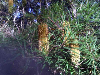
The route was muddy, and passed through forest, with many colorful Banksia flowers in bloom.

See all of the Photos of my visit!

Sunday, April 08, 2012

Tomahawk Creek Walking Track - Kurth Kiln Regional Park


These pix were taken on April 7  2012, in the Kurth Kiln Regional Park, 65 km east of Melbourne.


They show the scenery and environment along the 3 km (return) Tomahawk Creek Walking Track, which follows the Tomahawk Creek to Shepherd's Creek Rd.


This track passes through stands of lush ferns, and can be slippery in places.


See the complete set of Photos of my visit, and my YouTube video!


Sunday, May 01, 2011

Kurth Kiln Regional Park - Waterchannal Firetrail


These pix were taken on Saturday April 30, 2011, in the Kurth Kiln Regional Park, 65 km east of Melbourne.

They show the scenery, forest environment, and fauna along the southern section of the Waterchannel Firetrail.

This signed track starts at the Launching Place to Gembrook Rd, and ends at the Spencer Firetrail. It crosses the Tomahawk Creek billabongs at its lowest point.

Average altitude is 250 m asl.

The area was once a logging region, and has been subject to serious bushfires in recent decades.

See all of the Photos!

Monday, April 11, 2011

The Kurth Kiln Track - Kurth Kiln Regional Park


This group of pictures was taken in the Kurth Kiln Regional Park, 65 km east of Melbourne, on April 11, 2011.

They show the environment on the Kurth Kiln Track, a 2 km return hike which started at the Kurth Kiln Picnic Ground.

Some nice early-autumn fungi had appeared!

Yes, the color of the land is very reddish.

See all of the Photos of my visit

Kurth Kiln 2011 Heritage Festival


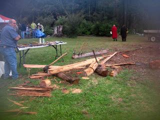
The annual Kurth Kiln Heritage Festival was held on Sunday April 11, 2011, at the Kurth Kiln Picnic Ground, near the corner of Beenak and Soldiers Roads, Gembrook, 65 km east of Melbourne.

A highlight of the events at the historic charcoal-producing kiln precinct was a recreation of an armed hold-up on a stagecoach.

The festival helps raise money for the preservation of the remains of the kiln, workers’ huts and associated buildings.

The kiln was built during World War II to make charcoal for use in gas-producer units fitted to motor cars. The units produced a combustible gas as a substitute for petrol, which was heavily rationed until hostilities ceased.

Festival spokeswoman Ursula Klink said in the Pakenham-Cardinia Leader that the friends group urgently needed money to restore and preserve what remained of the kiln.

“It was a key part of our wartime transport history. In many instances, gas producers on vehicles made the difference between being able to use them and leaving them in the garage,” Ms Klink said.

“The fuel was nowhere near as user-friendly as petrol and its use was discontinued almost as soon as alternatives were available. But in its day, it was quite valuable to a lot of people.”

The Gembrook Singers and the Weathered Heads Bluegrass Band weere among the entertainers. For the mechanically minded, there were historic and heritage machinery displays and lectures on the operation of gas producers.

Craft stalls, environmental displays and sheep shearing attracted many visitors and there were games and face painting for youngsters.

And for the energetic, there were bush walks in the 3500ha park!

Refreshments were provided by Hoddles Creek Red Cross.

Despite the rainy and bleak weather, everyone had a good time!

Enjoy my Candid Camera :Photos!

Wednesday, March 30, 2011

Tom's Track - Kurth Kiln Regional Park


These pictures were taken on Tuesday March 29 2011 in the Kurth Kiln Regional Park, 80 km east of Melbourne.

They show the scenery and bushland along Tom's Track, which was a 4 km (return) hike in former loggging forest.

This track links the Gembrook-Launching Place Rd with Soldier's Rd, and descends steeply to a crossing over Tom's Creek, passing Firewood Track.

See all of the Photos of my visit!

Wednesday, January 26, 2011

Tomahawk Creek Track - Kurth Kiln Park


Tomahawk Creek Walking Track, 4 km, is in the Kurth Kiln Regional Park, 65 km east of Melbourne.

Starting at the Kurth Kiln Picnic Ground, it passes through lush green fern gullies, tall forest, and along the banks of the Creek.

There are many unusual large rock formations and an interesting Gorge and waterfalls.

The historical Kiln, outbuildings and large dam are nearby

My visit was on January 25, 2011, a hot day!

See all of the Photos