Rotating Headlines from this Weblog! Click to view Post!

Rotating Headlines

Join this Weblog!

To become a Follower of this Weblog.
Click on the "Follow" link, underneath the list of current followers. You will be taken to an information panel where you may enter your personal details and other information. When completed, the title of this Weblog will appear in the Reading List on your Blogger Dashboard, and your Profile Picture will be displayed next to other Followers!

Followers to my Weblog!

Showing posts with label pound bend. Show all posts

Thursday, March 29, 2012

Warrandyte SP - Pound Bend River Hike

These pix were taken on March 28 2012 in the Warrandyte State Park, 15 km east of central Melbourne.

They show the scenery and environment along the Pound Bend River Walk, 3 km return, which starts at the Pound Bend Picnic area.

The Yarra River was at a low level, exposing many rocks which are usually underwater.

See all of the Photos of my visit, and check out my YouTube Video!

Tuesday, January 10, 2012

Pound Bend Track, Warrandyte State Park


Pix taken on January 9, 2012, in the Warrandyte State Park, 20 km east of central Melbourne.

They show the environment, scenery, and flora along the Pound Bend Track next to the Yarra River, a 4 km return hike starting at the Pound Bend Picnic Ground.

About 100 years ago, it had been proposed that this land would become a Koala Sanctuary, hut the plan was abandoned.

See all of the Photos of my visit, and check out the YouTube movie to hear the bird calls!


Tuesday, July 12, 2011

Warrandyte State Park - Pouind Bend in mid-winter


These pictures were taken on July 11, 2011 in the Warrandyte State Park, 20 km east of central Melbourne.

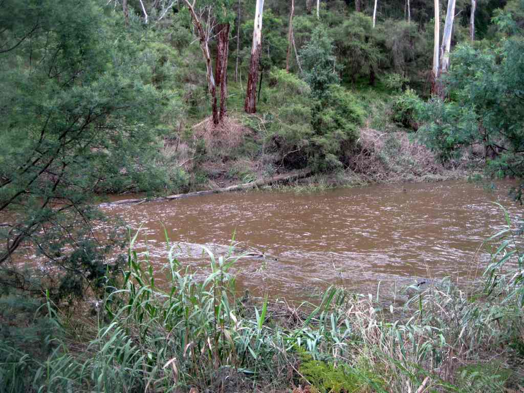
They show the scenery and environment along the Pound Bend Walking Track, adjacent to the Yarra Rivber (in flood mode).

There are also some kangaroos playing in their paddock!

See all of the Photos of my visit!

Friday, March 18, 2011

The Kangaroos at Pound Bend - Warrandyte State Park


These photos was taken on March 17, 2011, in the Pound Bend Section of the Warrandyte State Park, 20 km east of central Melbourne.

They show the Yarra, the scenery, and kangaroos having a good time in their Kangaroo Paddock!

This was a a 3 km return hike along the Pound Bend Trail, starting at the picnic ground.

View the Video, and see all of the Photos

Monday, February 14, 2011

Yarra River at Pound Bend, Warrandyte SP


These photos were taken on Sunday February 13, 2011 in the Warrandyte State Park, 20 km east of central Melbourne.

They show the scenery and action along the Yarra River, on a 4 km return hike, which started at the Pound Bend Picnic Ground - turnaround was at the bottom of the large Kangaroo Paddock, adjacent to, and managed by Parks Victoria Warrandyte regional depot.

The Yarra was flowing strongly, due to the effects of recent heavy rain, and many large trees had fallen into the river.

I have included an archival image showing what the Pound Bend Picnic Ground looked like in the year 1909! The people are having a good time on a seesaw - note the small boy in the foreground, partly hiden behind a stump, with an accordeon.

See all of the Photos!

Friday, November 26, 2010

Warrandyte State Park - Pound Bend hike


These photos were taken on Thursday November 25, 2010, on a 3 km hike in the Pound Bend area of the Warrandyte State Park, 25 km east of central Melbourne.

See all of the Photos, which show the Yarra (flood level), the Pound Bend Walking Track, some spring wildflowers, and a resident of the Kangaroo Paddock!

Sunday, February 14, 2010

Exploring Tank Track, Warrandyte State Park


On Saturday February 13, 2010, I did a 4 km hike around the Pound Bend area, Warrandyte State Park, 20 km east of Melbourne town.

Tank Track is high on the ridge, above the former orchard. It is named for the large fire-management water tank on the summit, which is about 80 above sea level.

See all of the Photos of my visit!

Tuesday, December 22, 2009

Pound Bend Walking Track to Kangaroo Paddock


On Monday afternoon December 21, 2009, I went over to the Warrandyte State Park, 15 km from the Melbourne CBD.

I left the car at the Pound Bend picnic ground and followed the Pound Bend Walking Track alongside the Yarra, to the Kangaroo Paddock.

The Paddock is actually in a large area of cleared land managed by Parks Victoria and walkers are permitted in it.

A few of the resident Eastern Grey kangaroos were frolicking at the far end of the paddock!

This was a 4 km hike, through bushland.

See all of the Photos of my visit!

Friday, November 06, 2009

Yarra River - Pound Bend Hike - Warrandyte State Park


On Wednesday November 4, 2009, I went over to the Warrandyte State Park, 15 km from the Melbourne CBD.

I did the 4 km (return) Pound Bend Track, starting at the Pound Bend Picnic Ground, and continuing on the relatively unknown extension track around the Kangaroo Paddock.

See all of the Photos of my visit, which shows views of the Yarra River, kangaroos, a galah, a nice fungus, a duck family, and the Picnic Ground.

Historical photos show the Picnic Ground as it looked in the years 1900 and 1940!

Wednesday, July 29, 2009

Pound Bend Hike - Warrandyte State Park


On Tuesday afternoon July 28, 2009, I visited the Pound Bend Section of the Warrandyte State Park, 20 km east of the Melbourne CBD.

My 5 km exploration took me along the main Walking Track, adjacent to the Yarra River, to the large open paddock managed by Parks Victoria.

I continued along the river bank next to the paddock on an "unofficial" track, passing the high rocky cliffs to my turnaround point.

Mobs of Eastern Grey Kangaroos reside in the big paddock - they were watching me, some with cute Joeys!

On the main Track, I saw an unusual unidentified beautiful bird.

See the complete set of Photos of my visit!

Sunday, June 28, 2009

Orchard Track, Pound Bend,Warrandyte State Park


On Saturday afternoon June 27, 2009, I went over to the Pound Bend Section of the Warrandyte State park, 25 km east of the Melbourne CBD.

My task was to investigate and explore the site of the former large farm and orchard, which occupies the extreme easterly end of the Pound Bend Peninsula, adjacent to the Yarra River.

Parks Victoria owns and manages this area, and their depot, workshops, stores, and buildings are located there.

Two interesting walking tracks were explored - the Orchard West Track, and the Farm Circuit Track.

Access to these Tracks is from a small car park at the start of unsigned Tank Track, opposite the main gate of the Parks Victoria facility, at the end of sealed Pound Bend Rd.

Orchard West Track leads down to the river, and then westerly through the site of the former orchard, ending at high impassable cliffs near the Pound Bend Tunnel.

Directly opposite is the Norman's Bushland Reserve, and the Rapids.

Many of the original orchard plantings have survived, but are being overgrown by weeds.

Gold mining at Pound Bend ceased in 1909, agriculture stopped in 1985, and grazing ceased in 1996.

The Farm Circuit Track leads off from the Orchard West Track, and follows the perimeter of the old farm around a large cleared area, next to the river. This track ultimately ends at a small gate at the junction of the Pound Bend Walking Track, which is followed up the hill to the YHA cairn. From there it is a short distance do the car park.

Large mobs of Eastern Grey Kangaroos reside in this area!

The first Youth Hostel in Australia was at this location, built in 1940, but no trace remains.

The total walking distance was about 4 km, through this section of the Park which is not often visited by hikers.

There are no signs, but the tracks are shown in the Parks Vic Management Plan. The Plan states that it is not intended to develop the orchard site for day visitors.

See the full set of Photos of my visit.

Sunday, February 15, 2009

Exploring Pound Bend - Warrandyte State Park


Warrandyte, 20 km east of the Melbourne CBD, is the site of Victoria's first gold discovery. The find at Anderson's Creek by Louis Michel, in 1851, marked the start of the Victorian gold rush and an influx of people into the area. The approximate location of the site is marked by a cairn on Fourth Hill in the Warrandyte State Park.

Another major location of gold in Warrandyte and Melbourne was the Yarra River. All through Warrandyte the river shows signs of being exploited, a classic example is the tunnel at Pound Bend.

The Pound Bend Tunnel was created in 1870 by a goldmining company in order to divert the course of the Yarra River, thereby enabling the exploitation of the old riverbed. It is now a popular swimming spot.

The river was partially dammed at Pound Bend near Norman's Reserve at its eastern entrance and near Bob's wetlands at its western exit. Miners then blasted a 300m long tunnel through solid rock. The river was then fully dammed at the entrance and exit to the tunnel and water was diverted through 300m and out the other side leaving an astonishing 3.85 km of riverbed around Pound Bend exposed to the sun and the miners picks.

The Pound Bend Reserve is popular in summer. There are grassy areas for picnicking, a walking track along the river which supplies access to koalas and a variety of flora, toilets (including disabled facilities), information boards, canoeing, swimming and horseriding opportunities and a nature walk.

I visited this interesting historical place on February 12, 2009. This included a 4 km return hike along the main Walking Track next to the river along the river bank.

See the full set of Photos

Tuesday, December 09, 2008

The Pound Bend Peninsula, Warrandyte State Park


Some of the best views of the Yarra are to be found along the walking track which starts at the Pound Bend picnic ground/car park, Warrandyte State Park, 25 km east of the Melbourne CBD.

The 4 km (return) track passes through bushland, over a series of footbridges, finally reaching a large grassed paddock, managed by Parks Victoria.

This is the eastern end of the Pound Bend Peninsula.

Another track continues across the paddock, crossing the Pound Bend Road, and returning to the picnic ground via Tank Track.

There are many vantage points along the river bank, with rapids and views to the cliffs on the northern side.

Families of ducks live on and near the river! Koalas may occasionally be seen - snakes are prevslent in the hotter months.

I did this interesting hike on December 8, 2008.

See the full set of Photos

Friday, October 31, 2008

Jumping Creek Hike, Warrandyte SP


There are some good walking tracks starting at the Jumping Creek Picnic Ground, Warrandyte State park, 20 km east of the Melhourne CBD, following the winding Yarra River.

An interesting shorter walk of about 2 km follows the Pound Bend Track, then on to the Nature Trail, and back along the gated management road.

This offers good views of the Yarra from the clifftop, and passes through regrowth bushland.

The Picnic Ground has barbecue facilities, toilets, and an information board. A map in a plastic cover of the Pound Bend Track can be borrowed from the box at the start of the track. The Map should be returned!

There are numbered markers along the track, with the features described on the map.

My trip was on October 30, 2008.


See the full set of Photos of my journey