New Pages Added

VISITORS!

Monday, May 30, 2011

Bright Pictorial Heritage research project published

Bright in 1870

First train to Bright 1891

Apex Lookout

View from Huggins Lookout 2010
I am pleased to announce the publication of my "Bright Pictorial Heritage" website, a free research project which traces the development, history and evolution, from 1850 until 2011, of the beautiful town of Bright, in the foothills of the Victorian Alps, 350 km NE of Melbourne.

Bright has a rich and colourful history, from its beginnings in the 1850s as a gold rush region, and is now a popular tourist destination, as a gateway to the Mt Buffalo National Park, and the Alpine National Park. It is also the terminus of the Rail Trail, which follows the route of the former Bright Railway.

I first visited Bright in January 1961, on a camping trip with my younger brother, on our way to the Snowy Mountains Hydroelectric Scheme.

In the decades since, I have made many trips to Bright, in pursuit of my interests in hiking, long distance shortwave radio monitoring and photography.

The website has 26 pages, and contains hundreds of images, comprising heritage photos from the 1860s, and my own photos taken between 1961 and 2011,linked by my own articles and discussions.

THere is also a 2011 Video.

The site is at http://bpadula.tripod.com/bright

If you have never been to Bright, you might like to take a drive there and experience for yourself the wonderful bushland scenery and Alpine environment, at any time of the year, and take a little time to explore the picturesque town, the Ovens River, the network of walking tracks and heritage features.

I'd be interested in your reactions and comments about this new Heritage Project!

Regards from Melbourne!

Bob Padula,

Sunday, May 22, 2011

O'Shannassy Aqueduct Trail - Parrot Rd section


Now part of the Yarra Ranges National Park, the O'Shannassy Aqueduct Trail is a long, step-on, step-off 27 km walking/cycling/horse route starting at Parrot Rd, near Woori Yallock, and ending at the O'Shannassy Weir, McMahon's Creek, about 80 km east of Melbourne, past the town of Warburton.

The Aqueduct, which includes some underground pipe and syphon sections, was constructed between 1911 and 1915, and decommissioned in 1997. The maintenance track, known as Road 18, has been opened up progressively for walkers, horse-riders and cyclists, following transfer of land ownership from Melbourne Water to Parks Victoria.

The Trail passes through magnificent Mountain Ash forest, past fern gullies, with excellent views across the Yarra Valley towards Mt Little Joe and the mountains near Big Pats Creek. It winds its way around the base of Mt Donna Buang, Mt Victoria and Ben Cairn, passing many aqueduct engineering works, bridges, syphons, huts, distance marker posts and old maintenance sheds.

New access gates for management vehicles and walkers have been built at various locations along the route.

Sadly, there has been massive encroachment of vegetation, fallen trees, branches, and weeds in sections of the Aqueduct.

I have completed the 25 km of the Trail - 50 km return, in several trips!

On Saturday May 21, 2011, I explored the final section of the Trail to be opened, starting at the access point at the newly constructed crossing at Parrot Rd, Woori Yallock.

This was about 4 km return, up and down steep terrain.

There were some nice views towards the Dandenong Ranges.

See all of the Photos of this trip!

Thursday, May 19, 2011

Shoreham Beach Pictorial Heritage - new project released


I am pleased to announce the publication of the "Shoreham Beach Pictorial Heritage" website, a free research project which traces the development, history and evolution of the scenic Shoreham Beach since its beginnings in the early 1920s, until the present day.

Shoreham Beach is 80 km south of Melbourne, in the Mornington Peninsula, on Westernport Bay, and has a colourful and rich history, having started as a fishing port.

I first visited Shoreham in January 1952, on a 10-day camp at the YMCA's Camp Buxton, which was for underprivileged 10-14 year old boys from across Victoria. Photos of that trip are at the website! Many thousands of boys attended the Camp in the years 1939 to its closure in 1955.

There are three sections in the website about the history of the YMCA in Victoria, and Camp Buxton.

In the decades since, I have made many trips to Shoreham, in pursuit of my interests in rockpooling, swimming, beach-walking, hiking, long distance shortwave radio monitoring and photography.

The website contains many heritage images dating to 1907, supplemented by my own photos and videos taken in 2011 and linked by many articles and discussions, some humorous. These include photos of Camp Buxton as it looks today - many of the original buildings and features have survived.

Following its closure, Camp Buxton was subdivided - a major part was bought by Council and became the Buxton Bushland Reserve. The remainder is now a B&B business.

The site is at http://bpadula.tripod.com/shoreham

If you are in Melbourne and haven't been to Shoreham, or a visitor, you might like to take a drive down to Shoreham and experience for yourself the wonderful bushland and coastal scenery, at any time of the year.

I'd be interested in your reactions and comments on this new website!

Regards from Melbourne!

Bob Padula

Sunday, May 15, 2011

Millgrove - Yarra River Hike


These pictures were taken on Saturday May 14 2011, at Millgrove, near Warburton, 70 km east of Melbourne.

They show the Yarra River in flood mode, on a 3 km hike along River Rd and Dee Rd.

An interesting foot-track follows the Yarra adjacent to Dee Rd, in the Melbourne Water Bushland Reserve.

See all of the Photos of my visit!

Wednesday, May 11, 2011

O'Shannassy Aqueduct Trail - Don River section now open

Mt St Leonards seen from Malleson Lookout

Malleson Glen curved heritge bridge

O'Shannassy Trail - footbridge over Don River

Don River, from bridge on O'Shannassy Trail
Now part of the Yarra Ranges National Park, the O'Shannassy Aqueduct Trail is a long, step-on, step-off 27 km walking/cycling/horse route starting at Parrot Rd, near Woori Yallock, and ending at the O'Shannassy Weir, McMahon's Creek, about 80 km east of Melbourne, past the town of Warburton.

The Aqueduct, which includes some underground pipe and syphon sections, was constructed between 1911 and 1915, and decommissioned in 1997. The maintenance track, known as Road 18, has been opened up progressively for walkers, horse-riders and cyclists, following transfer of land ownership from Melbourne Water to Parks Victoria.

The Trail passes through magnificent Mountain Ash forest, past fern gullies, with excellent views across the Yarra Valley towards Mt Little Joe and the mountains near Big Pats Creek. It winds its way around the base of Mt Donna Buang, Mt Victoria and Ben Cairn, passing many aqueduct engineering works, bridges, syphons, huts, distance marker posts and old maintenance sheds.

New access gates for management vehicles and walkers have been built at various locations along the route.

Sadly, there has been massive encroachment of vegetation, fallen trees, branches, and weeds in sections of the Aqueduct.

I have completed the 25 km of the Trail - 50 km return, in several trips!

On Tuesday May 10, 2011, I explored the final section of the Trail to be opened, starting at the access point at the newly constructed crossing at Don Rd, Launching Place.

At this point, the Trail descends westerly on a stairway, then crosses a new footbridge over the Don River, and then reaches a crossing at Ewart's Rd. There is a small car park and access gate here. The Trail continues up hill for another 4 km to its end at Parrot Rd.

There is an informative display board and map at the Ewart's Rd car park.

See the Parks Victoria site for full details and maps:

www.parkweb.vic.gov.au/resources05/05_1751.pdf

I followed scenic Don Rd from its start at Healesville - the Trail crossing is about 4 km from Launching Place.

After leaving Healesville, Don Rd passes the Malleson Lookout at Panton's Gap, which offers interesting views across the Yarra Valley towards Mt St Leonards and the Yarra Ranges.

After leaving the Lookout, where there is an old "VP" marker post (meaning "View Point"), the road passes the Nyora Rd turnoff to Mt Toolebewong, then reaches the junction of the high-level Mt Donna rd (closed in winter). From there, the unsealed Don Rd winds its way down through rugged forest, arriving at Malleson's Glen and the heritage-listed curved wooden bridge, built in 1930.

The Glen is a beautiful fern gully on the Don River - it is adjacent to a property originally part of a larger area of land owned by a Melbourne solicitor named Malleson in the late 1890s.

Holly hedges and landscaping was done by Malleson, who made his property available to members of the public. Access was from the Healesville end.

Nowadays, the holly has gone wild and spread into the forest.

The land is now privately owned and is at the foothill of Ben Cairn.

In the 1880s, Malleson's Lookout was originally reached by foot, horse or wagonette from Healesville, along Malleson's Track.

Don Rd was built in the 1920s.

See all of the Photos of my "drive/hike" tour!

Sunday, May 08, 2011

Russell's Sawmill - Bunyip State Park


These pictures ere taken on Saturday May 7, 2011, in the Bunyip State Park, 70 km east of Melbourne.

They show the scenery and environment along the Ash Landing Rd, reached from a turnoff at the Black Snake Creek picnic ground, off Black Snake Creek Rd.

Ash Landing Rd derives its name from the logging era, when huge Mountain Ash trees were cut down and hauled by a steam driven tramway from a sawmill to a "landing" on the present-day Black Snake Creek Rd.

This sawmill was one of several operated by Bill Russell in the 1920s and 1930s - his company was the most important sawmill enterprise in the district.

No trace of the tramway remains - the Ash Landing Rd follows the alignment.

The sawmill site is just off Ash Landing Rd, next to Russell's Creek, but is now overgrown and a large water-point/dam covers it.

See all of the Photos of my visit!

Saturday, May 07, 2011

Mt Donna Buang Pictorial Heritage


I am pleased to announce the publication of my comprehensive MT DONNA BUANG HERITAGE EDITORIAL RESEARCH PROJECT, spanning the years from 1890 to 2011.

I'm inviting you to check out this special project, which is now available on-line at
http://bpadula.tripod.com/donnabuang


Its articles, stories, images, maps and engravings describe the development and evolution of this magnificent area within the Yarra Ranges National Park surroundings, 80 km east of Melbourne, just past the town of Warburton, spanning the years years 1890 until 2011.

Extensive use has been made of information sourced to old Victorian newspapers, using the National Library of Australia's on-line digitization system.

I have always maintained a strong and continuing interest in the Mt Donna Buang and nearby areas, from my first trip there in August 1951 as an excursion with the YMCA.

I have included some images of that first visit scanned from my original 2.5" x 3.5" black/white prints, taken on my faithful Box Brownie, still in good working order!

The region has also been a good location for HF radio monitoring in recent years, supporting my interest in long distance radio propagation.

The project is arranged in these Chapters:

  • History of Mt Donna Buang
  • Warburton History
  • Heritage Timeline
  • Gold, Logging, and Timber Tramways
  • Ben Cairn
  • Acheron Way
  • Snow Sports
  • My Family Snow Photos of 1925
  • Bushwalking Tracks
  • O'Shannassy Aqueduct Trail
  • Mt Donna Buang Rainforest Gallery and Skywalk
  • Mt Victoria Towers and HF Radio Reception
  • Maps
  • References and Bibliography

I would welcome your feedback and reactions on this Project - there is a Guest Book at the site.

I hope you enjoy your tour through time of the Mt Donna Buang Region - now one of Victoria's most famous tourist attractions within a short distance of Melbourne.

Regards!

Bob Padula
Melbourne

Thursday, May 05, 2011

Exploring the Yarra River - East Warburton


These pictures were taken on May 4, 2011.

They show the scenery and environment on a 2 km hike adjacent to the Yarra River, East Warburton, 80 km east of Melbourne, opposite the Big Pat's Creek Rd turnoff.

In 1910, a steam timber tramway commenced operating between Warburton and Big Pat's Creek, and a large Seasoning Works existed at the corner of Big Pat's Creek Rd and the Wood's Point Rd.

The tramway remained in use until 1973 - trackwork arond the site remained in place until 1980 when the rails were recovered and sold for scrap.

Now, the site is private property, used for grazing.

See all of the Photos of my visit.

Sunday, May 01, 2011

Kurth Kiln Regional Park - Waterchannal Firetrail


These pix were taken on Saturday April 30, 2011, in the Kurth Kiln Regional Park, 65 km east of Melbourne.

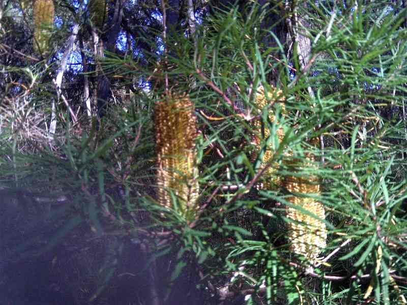
They show the scenery, forest environment, and fauna along the southern section of the Waterchannel Firetrail.

This signed track starts at the Launching Place to Gembrook Rd, and ends at the Spencer Firetrail. It crosses the Tomahawk Creek billabongs at its lowest point.

Average altitude is 250 m asl.

The area was once a logging region, and has been subject to serious bushfires in recent decades.

See all of the Photos!