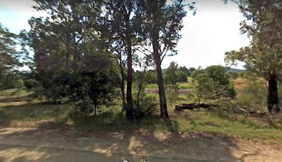
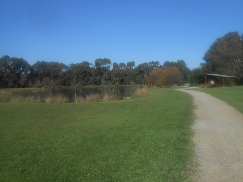
These photos show the scenery and environment on a 3 km hike in Kalang Park on April 28, 2021.
The Blackburn Creeklands consist of three continuous
bushland reserves along Gardiners Creek in central Blackburn. Blacks
Walk, Kalang Park and Furness Park form a green corridor
featuring a delightful mixture of both bushland and open space areas.
The creeklands helps preserve the local environment whilst providing
opportunities for a variety of recreational and educational activities.
The three parks cover a total area of approx 21 hectares, extending
1.4km from Middleborough Rd in the west to Blackburn Rd in the east.
Kalang Park
Of the three parks within the Blackburn Creeklands, Kalang Park is the
largest. Stretching almost 1km from Pakenham to Main Streets, with an
area of approximately 9 hectares, this park holds an abundance of
features to explore. Accessed through a large network of gravel tracks
and narrow pathways along both sides of the creek, the northern section
of Kalang Park is largely indigenous bushland. Glimpses are possible of
tawny frogmouths in the crook of any of the large mature eucalypts and
galahs and kookaburras can be heard in the trees above. In the
billabong are frogs and in spring, this is a great place to sit and
watch the wood ducks swimming with their ducklings. South of the creek
there are opportunities for passive and active recreation. These are
open grassed areas for sport and activities such as kite flying, as well
as revegetated pockets to explore. After rainfall, the ephemeral wetlands depressions that skirt the southern pathway hold water and create a unique and interesting environment.
The block on which the sports oval is located was acquired in 1966 by the City of Nunawading to form Kalang Reserve. In addition to the oval, Kalang Park also includes former MMBW land acquired after the successful “Up the Creek!” campaign (1981-1983) which links and integrates the three parks.
Furness Park
East of Main Street, this park forms part of the Whitehorse Heritage
Trail and features a great playground and walking tracks. Perceived as
‘healthy place to live’ in 1910, Blackburn was home to ‘Open Air School’
that was situated overlooking Furness Park. Children from poorer
backgrounds took the train to Blackburn Station to attend the school
receiving a healthier food and a chance to bask in the sun to increase
their Vitamin D intake. The school closed in 1963. An interpretive
panel offering historic anecdotes is located on the western boundary of
the park.
The City of Nunawading purchased Furness Park in 1941 so as to preserve land for indigenous plants and wildflowers.
 The block on which the sports oval is located was acquired in 1966 by the City of Nunawading to form Kalang Reserve. In addition to the oval, Kalang Park also includes former MMBW land acquired after the successful “Up the Creek!” campaign (1981-1983) which links and integrates the three parks.
Furness Park
East of Main Street, this park forms part of the Whitehorse Heritage
Trail and features a great playground and walking tracks. Perceived as
‘healthy place to live’ in 1910, Blackburn was home to ‘Open Air School’
that was situated overlooking Furness Park. Children from poorer
backgrounds took the train to Blackburn Station to attend the school
receiving a healthier food and a chance to bask in the sun to increase
their Vitamin D intake. The school closed in 1963. An interpretive
panel offering historic anecdotes is located on the western boundary of
the park.
The City of Nunawading purchased Furness Park in 1941 so as to preserve land for indigenous plants and wildflowers.