Rotating Headlines from this Weblog! Click to view Post!

Rotating Headlines

Join this Weblog!

To become a Follower of this Weblog.
Click on the "Follow" link, underneath the list of current followers. You will be taken to an information panel where you may enter your personal details and other information. When completed, the title of this Weblog will appear in the Reading List on your Blogger Dashboard, and your Profile Picture will be displayed next to other Followers!

Followers to my Weblog!

Showing posts with label ferns. Show all posts

Monday, May 21, 2012

Marysville State Forest - Gilbert's Gully Loop Trail


These pix were taken on May 21 2012 in the Marysville State Forest, 90 km east of Melbourne.


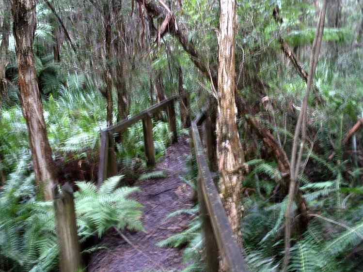
They show the environment and scenery along the 3 km Gilbert's Gully Loop Trail, which starts near the main road to Marysville, at the western edge of the town.

The Trail crosses the Wilk's Creek twice, on bridges and a boardwalk, and winds its way around the lower slopes of Mt Gordon.

The Gully is noted for its lyrebirds, but none were seen!

See all of the Photos of my visit!

Tree Fern Gully Trail - Marysville State Forest


These pix were taken on May 21, 2012, in the Marysville State Forest, 90 km east of Melbourne.


They show the scenery and environment along the Tree Fern Gully Trail, on a 3 km (return) hike starting at the footbridge next to the football oval.


The Trail follows the Steavenson River, reaching another bridge at the junction of the Keppel Lookout Track.


See all of the Photos of my visit!


The Fern Gully Trail contines for another 2.4 km to the Falls carpark.

See all of thd Photos of my visit!

Sunday, May 20, 2012

Mortimer Nature Trail - Bunyip State Park

These pix were taken on May 20 3012.


They show the scenery and environment along the 2 km Mortimer Nature Trail, Bunyip State Park, 70 km east of Melbourne.

The circuit trail started at the Gembrook-Tonimbuk Rd, snd crossed the Diamond and Wallace Creeks.

Information signs along the Track describe points of interest.

See the Slideshows, below! Animoto is an animated video, 30 secs duration.


Enjoy!


Make your own slide show at Animoto.

Wednesday, May 16, 2012

Exploring the Woodduck Track, Kurth Kiln Regional Park


These pix were taken on a 2 km circuit hike along the Woodduck Track, Kurth Kiln Track, and Beenak Rd, in the Kurth Kiln Regional Park, 60 km east of Melbourne, May 15 2012.

The route was muddy, and passed through forest, with many colorful Banksia flowers in bloom.

See all of the Photos of my visit!

Monday, May 07, 2012

Kurth Kiln Regional Park - Shepherd's Creek Hike


Pix taken on May 5 2012 on  a 3 km (return) hike in the Shepherd's Creek Gully, Kurth Kiln Regional Park, 80 km east of Melbourne.


The walk started at the junction of Shepherd's Creek Road and Shortcut Track.


The creek was flowing strongly, after recent heavy rains, and this section of the Park is very lush and green, with many tree ferns.


See all of the Photos of my visit!

Saturday, March 14, 2009

Hardy Gully Nature Trail - Kallista


On March 14 2009 I visited Grant's Picnic Ground, Kallista, in the Dandenong Ranges National Park, about 35 km from the Melbourne CBD.

From there I walked some 3 km along the Lyrebird, Hardy's Gully, and Neumann Tracks, reaching my turnaround point at Wallaby Paddock.

This paddock was once a potato farm in the 1940s - no traces of any buildings remain, but parallel lines of furrows are still visible.

This was a cool and rainy day, bit this not deter the many parrots, galahs and white cockatoos who know where to go to get their seeds!

See the complete set of
Photos of my trip!

Sunday, February 22, 2009

Exploring the Olinda Falls in mid-summer


The Olinda Falls are among the most popular attractions in the Dandenong Ranges National Park, 30 km from the Melbourne CBD.

There are actully three falls - the upper, middle and lower cascades, with viewing areas for each along the 1 km steep track which starts at the picnic ground on Falls Rd.

Visitors have enjoyed the Falls since the 1860s, well before motor cars made their appearance in Melbourne, when they travelled up Mt Dandenong by horse and buggy!

The Falls were originally known as the "Valinda Falls", the name of the district, which then became "Olinda".

Olinda settlement is perched on the rim of the ancient volcano crater, which last erupted 200 million years ago!

Please see my Photo Album of the trip, which shows the walking track, signposts to nearby trails, the falls, the picnic ground, the car park, and the viewing platforms. It includes two archival photographs, showing the Falls Walking Track, and what the Falls looked like around the year 1910.

I visited the
Olinda Falls on February 20, 2009.

Monday, February 16, 2009

Hermon's Track - Olinda Forest


Hermon's Track is a popular 3 km walking/cycling/equestrian trail in the Olinda Forest, Dandenong Ranges National Park, 35km east of the Melbourne CBD.

It is reached from the Eagle Nest picnic ground, off Silvan Rd, and follows the Lyrebird Creek valley.

It passes through regrowth forest, fern gullies, and across the creek, with cockatoos screeching overhead!

My visit was on February 15, 2009.

See the full set of
Photos, which include some images taken at the nearby Woolrich Lookout, looking east towards the ranges around Gembrook, where bushfires were still burning in the Bunyip State Park.

Wednesday, February 04, 2009

A Hike in the Olinda Forest


On Tuesday February 3, 2009, I explored a seldom visited un-named track in the Olinda Forest, Dandenong Ranges National Park.

This 2 km track starts at gated Road 13, just off the Olinda Creek rd, and winds its way through interesting forest, along the Olinda Creek valley, ending at Road 13 near the bridge.

This track is not shown on any maps, and is not signposted!

See the full set of Photos, which include some historical images of the forest taken in 1869 and 1910!

Wednesday, January 21, 2009

Olinda Creek Track, Dandenong Ranges NP


The Olinda Creek Track is a 3 km circuit route, starting at the junction of gated Road 13, reached from a small car park on the Olinda Creek Rd.

It passes through good forest and beautiful ferns and tree-ferns on its way to the Olinda Creek.

There is a signpost at the junction with Road 13, and a side-track eventually comes out at the Olinda Creek Rd.

I explored this interesting track on January 20, 2009, a day of extreme heat, 40 degrees!

See the complete set of photos, and a map!

Monday, December 29, 2008

George's Rd Hike - Olinda Forest


George's Rd is a popular walking/cyvling/horseriding gated track in the Olinda Forest, Dandenong Ranges National park, 30 km east of the Melbourne CBD.

It is 4 km (return) and links the small car park at Olinda Creek Rd with Hermon's Track, passing through regrowth forest, tall timber, and ferns.

I hiked this track on December 28, 2008.

See the full set of Photos, which include some images taken from the nearby Nib Nab Nob Lookout, which overlooks the Forest.

Friday, December 12, 2008

A Hike akong the scenic Dam Rd, Olinda


Dam Rd is a gated management track in Olinda, Dandenong Ranges National Park, adjacent to the Hamer Arboretum, 30 km east of the Melbourne CBD.

It starts at the Woolrich Lookout on Chalet Rd, and winds its way around the perimeter of the Arboretum, passing a large fire management dam.

The views are excellent towards the Yarra Ranges.

Near the dam is a short track leading to a disused pumping station.

The dam is fed from run-off from the forest above.I explored this interesting area on December 11, 2008 - Dam Rd is about 2.5 km reurn from the Woolrich Lookout car-park.

See the Photos of this trip

Monday, October 13, 2008

A Hike on Hermon's Track, Olinda Forest


An appealing shorter walk of about 2.5 km includes Hermon's Track, in the Olinda Forest, Dandenong Ranges National Park, 30 km east of the Melbourne CBD.

Hermon's Track starts at the Eagle Nest Picnic Ground, off the Silvan Rd, and joins George's Rd, which merges with Eagle Nest Rd. The walk then continues in a loop on the opposite side of the Lyrebird Creek, back to the Picnic Ground.

My trip was on October 12,2008, through excellent tall forest, past fern gullies and tree ferns, to the accompaniment of screeching white and black cockatoos!

See the
Photos

Wednesday, October 08, 2008

A Hike along Neumann Track, Sherbrooke Forest


On October 7 2008 I visited the Sherbrooke Forest, in the Dandenong Ranges National park, 25 km east of the Melbourne CBD.

I did a 4 km (return) hike, starting at Grant's Picnic Ground, following Lyrebird Track and Neumann Track.

I explored Wallaby Paddock, the site of a farm of the 1940s - all that remains are the furrows in the cleared field.
One Kookaburra was watching me in the Paddock!

Back at Grant's, a cast of thousands had assembled - namely cockatoos, galahs, and parrots, a popular spot for their afternoon tea!

See the full set of Photos of my trip!

Thursday, September 25, 2008

Olinda Creek Track, Olinda Forest


On September 24, 2008, I hiked 2 km along an interesting unsigned and unmarked track in the Olinda Forest, Dandenong Ranges National Park, 35 km east of the Melbourne CBD.

This circuit started at the junction of Olinda Creek Rd and Road 13, easterly at first, then along gated Road 13 to a junction to the left near the bridge. Then westerly along the unsigned track, adjacent to the Creek and the large "Sylvan Vale" bulb farm.

The track looped back to the starting point on the Olinda Creek Rd.

Colorful spring wildflowers were in bloom along the track, which passes through a magnificient stand of very old eucalypts adjacent to the creek.

The Olinda Creek runs along the southern perimeter of the farm, managed commercially as "Tonkin's Bulbs". This farm, started in 1945, was not absorbed into the NP when the Olinda Section was added in 1997. It is the only remaining farm in this section of the NP, and occupies a very large cleared area, having survived the big bushfires of the 1950s and 1960s. It's surrounded on all sides by the National Park.

See the Photos of the trip.

Tuesday, September 09, 2008

Bobcat Track in Spring, Olinda Forest


The Bobcat Link Track is in the Olinda Forest, Dandenong Ranges Nastional Park, 30 km east of the Melbourne CBD.

It links George's and Bartlett Tracks, passing through the site of a former farm of the 1940s.

I walked this 4 km track on September 8, 2008, starting and finishing at the junction of the Olinda Creek Rd and George's Track.

Spring wildflowers were in coloful bloom!

See the Photos

Monday, September 01, 2008

La La Falls - Warburton


The La La Falls are in the former timber cuttting region, near the town of Warburton, 65 km east of Melbourne, in the Yarra State Forest.

A 3.5 km return walking track leads up to the Falls, through the dense jungle of the Four Mile Creek Gully.

The photos show the Falls and the scenery along the Track, on my visit on August 31, 2008, the last day of winter!

The Track is very slippery after heavy rain, and care is needed. Parts of it are rocky and steep, over steps and boardwalks, and it terminates at a viewing platform at the base of the Falls.

In the Photo Album, I have included an archival photo of the Falls as they looked in 1920!

Friday, August 29, 2008

Yarra River Walk - East Warburton


The Yarra River Walk is 3 km return, at East Warburton, 70 km east of Melbourne.

The walk starts near the Warburton Caravan Park on the Woods Point Rd, opposite the Mt Donna Buang Rd junction.

It follows the river, passing through dense bushland and ferns, on the alignment of the former Warburton to Big Pat's Creek Steam Railway, which closed down in 1950.

The turnaround point is at a pleasant open picnic ground on the Wood's Point Rd, next to the river.

Seats are located along the walk.

There are many ducks living near the river!

I did this walk on August 29, 2008.

Photos

Tuesday, August 26, 2008

Exploring the former Potato Farm, Olinda Forest


On August 25, 2008, I went out to the Olinda Forest, Dandenong Ranges National Park, 30 km east of the Melbourne CBD.

I ventured along the gated and seldom used Management Road 19, which passes through the former potato farm, a property which was acquired by Parks Victora several years ago.

The track crosses the Olinda Creek - the creek was diverted in the early days to support the activities of the farm - the old excavations are clearly visible. The creek reaches a small dam not far away.

The old homestead is now derelict, and plantings on the site have gone wild. Pine trees have grown to about 30 m tall, and yellow acacias are mixed in with tree ferns.

There are interesting views from the high point at the top of the site across the Olinda Valley.

My journey was about 2 km return.

See the full set of Photos

Thursday, August 21, 2008

Olinda Creek Valley winter hike


I visited the Olinda Forest on August 20, 2008, on a 4 km hike along Road 18, which follows the Olinda Creek, Dandenong Ranges NP, 30 km east of the Melbourne CBD..

I started at the gate on the Olinda Creek Rd, and my turnaround point was at the bridge, on Road 13, near the Flower Farm.

The creek was flowing strongly, and the track passed thrhough beautiful tall rorest and large tree ferns.

Kookaburras were making noises overhead in the canopy!

See the full set of Photos