To become a Followerof this Weblog. Click on the "Follow"link, underneath the list of current followers. You will be taken to an information panel where you may enter your personal details and other information. When completed, the title of this Weblog will appear in the Reading Liston your Blogger Dashboard, and your Profile Picture will be displayed next to other Followers!
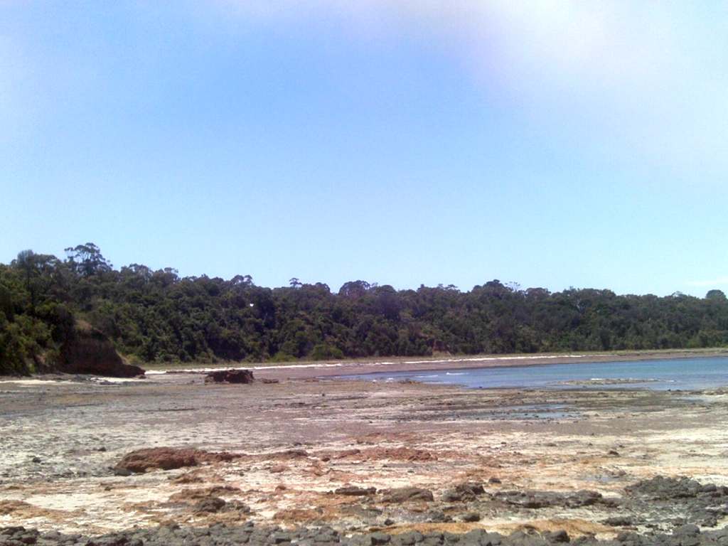
These pix were taken on February 1, 2012, at Somers Beach Foreshore Reserve, 70 km south of Melbourne, on Westernport Bay.
From the main carpark at Somers Village, my 2 km hike took me along the Sheoak Track to the Yacht Club, then down to the base of the cliffs and back along the beach.
See all of the Photos of my visit, and check out my YouTube video!
These pictures were taken on Sunday afternoon, January 29 2012.
London Bridge is a well-known rock formation at the extreme easterly tip of the Mornington Peninsula National Park, about 2 km from the town of Portsea, 90 km south of Melbourne.
The Bridge is reached by following the Portsea Ocean Beach Rd, then continuing to the Bridge car park.
A pathway follows the cliff-top, yielding excellent views of the Bridge formation.
Another track descends to the Beach, and from there it is a 350 m hike along the sand to the Bridge itself.
A pleasant 2 km walking path, known as the Farnsworth Track, passing along the tops of the sand dunes, links the London Bridge carpark and the Portsea Ocean Beach.
There is an excellent Lookout on this Track, not to be missed!
After exploring the Bridge, I hiked along the beach to the Portsea carpark,a total distance of about 3 km.
The fuzziness in some photos along the beach was due to a heavy heat haze which had come in from the ocean!
See all of the Photos of my visit, and check out my YouTube video!
These pix were taken on January 16, 2012, on a 4 km return beachwalk along the Shoreham Coast, 8 km south of Melbourne, on Westernport Bay.
The tide was out a long way, exposing beautiful rock pools and serene lagoons.
My hike started at the main car park, then along the beach to Honeysuckle Point and the magnificent reef.
I first visited Shoreham Beach on January 16 1952, exactly 60 years ago, when I attended a ten-day camp organized by the YMCA at Camp Buxton.
I have included a photo taken on that day, showing members of my family and my tent mates - I am at the left in a blue and yellow striped T-shirt and runners! This is a tinted photo which I created from the original scanned 620 size black and white print.
These pix were taken on December 28, 2011, at the Tulum Beach, Westernport Bay, 80 km south of Melbourne, on a 4 km (return) coastal hike starting at Balnarring Beach.
Watch the YouTube video (above) and see all of the Photos of my visit!
I visited the Point Leo Coastal Reserve on Westernport Bay on March 18, 2009.
Pt Leo is about 70 km SE of Melbourne, and offers surfing, safe swimming, boating, fishing, water birds, glorious coastal views, a camping ground, general store, walking tracks, and rock-pool exploring.
At low tide, vast reefs are exposed, where many exciting and interesting sea creatures may be observed.
There are excellent views of the coastline from the lookout at Crunchie's Point, just above the Boat Club. On this occasion, Phillip Island and the Nobbies/Seal Rocks were clearly visible across Westernport Bay 11 km to the east. The West Head at Flinders, was also prominent to the south-west.
My visit included a 4 km return beachwalk north-east towards Merricks Beach.
The coastal settlement of Flinders is about 90 km SE of Melbourne, and dates back to the 1830s.
On the western edge of the village is an outstanding and long-established golf course which sits atop the cliffs overlooking Bass Strait.
Near the entrance to the Golf Gourse is the the West Head Lookout, which offers grand views across Bass Strait, Westernport Bay, the Back Beach, Mushroom Reef, and the ocean coast towards Cape Schanck.
A walking track/stairway descends from the Lookout to Back Beach.
At the western end of Back Beach is the start of the Ocean Beach, adjacent to the Mushroom Reef Marine Sanctuary.
When the tide is out it is possible to see how the rocks form a T-shape which is thought to be a partial modification of a natural feature realised by the local Aborigines in order to aid their fishing activities.
Yellow triangular markers designate the boundaries of the Reef.
My visit was on Tuesday March 3, 2009, on a 4 km (return) beachwalk from the West Head Lookout along the Back Beach and Coastal Beach.
Witton's Reserve and car park is at the end of Reserve Rd, Wonga Park, in the Warrandyte State Park, about 30 km east of the Melbourne CBD.
It is situated on the banks of the Yarra River, at the canoe launching ramp.
Nice beaches are excellent for swimming and paddling, and when the level is low, rocks and rapids are exposed.
A walking trail follows the river to the north, crossing Brushy Creek and continuing to Mt Lofty.
There are beautiful views of the river from this trail, and picnic tables and seats are in a delightful shady setting about 1 km from the start.
There is a nice beach near the picnic area, suitable for swimming, paddling, and exploring the exposed river rocks.
I hiked this trail as far as the picnic area on January 29, 2009. This was a frightfully hot day, with temperature on the trail hovering around 48 degrees!
There were many visitors, and their dogs, enjoying the coolness of the river.
If you are so inclined, hire or take a canoe or kayak on the river, a pleasant experience.
See the full set of Photos of this very hot excursion!