To become a Followerof this Weblog. Click on the "Follow"link, underneath the list of current followers. You will be taken to an information panel where you may enter your personal details and other information. When completed, the title of this Weblog will appear in the Reading Liston your Blogger Dashboard, and your Profile Picture will be displayed next to other Followers!
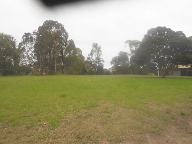
These images of April 26 2021 are of a 2 km circuit walk around the eastern section of Finn's Reserve, Templestowe. Start and end was the car park at the Suspension Bride over the Yarra, then through the bushland area, up the hill to the Scout Hall, then past the Wombat Bend Playground/Barbecue area to the Ruffy Shared Trail and the Yarra Lookout.
This is a Historical
Research Project, which looks at the planning, construction, evolution,
operations and closure of the Templestowe
Bridge, which crossed the Yarra, linking Templestowe
Township with Lower Plenty. It was built in 1855, and abandoned in the
mid-1930s. Reference is also made to the Odyssey House suspension footbridge
over the Yarra, nearby, built in 1950, and still
existing, and other notable features of the district!
VIDEO INTRO
Here is a short film produced by the Australian Government titled "The History of Melbourne's Yarra River"
BRIEF HISTORY - The Suburb of Lower Plenty
Current (2020) map of Lower Plenty (Google)
Until 1851, the area (now Victoria!), was part of New South Wales, then from 1851 until 1901 it was the Colony of Victoria, with its own government within the British Empire. In 1901 it became a state of the new Commonwealth of Australia.
Lower Plenty, in earlier times part of
Eltham, almost certainly got its name from the Lower Plenty Toll Bridge,
built in 1860 to collect tolls across the Plenty River. This bluestone
bridge still stands as part of the Lower Plenty Trail. A report of a
court case, in The Argus
newspaper, dated 1 May 1879, reveals two lads, Corkhill and Hodgson,
"broke the windows of the old tollhouse, Lower Plenty bridge", some 19
years after the bridge was built.
The suburb is bounded by the Plenty River in the west until it joins the Yarra River,
which forms the southern boundary. Fitzsimons Lane forms the eastern
boundary and Airlie Road north of Main Road (a continuation of Lower
Plenty Road from the west) forms the northern bouindary.
Lower Plenty has a low density of urban dwellings compared to nearby
suburbs, and is dominated by large homesteads that are built away from
the main roads. These houses sharply contrast with the relatively
undeveloped roads (some unsealed) and infrastructure of the area.
The suburb of LOWER TEMPLESTOWE
Add caption
The Traditional Owners of the land that came to be known as Lower Templestowe were the Wurundjeri people. They never relinquished ownership, rather, the land was stolen from them by British Colonial Authorities.
In 1841 Frederic Unwin, a Sydney
solicitor, purchased 5,120 acres, or eight square miles of land,
including most of the present suburb of Lower Templestowe, from the
Crown, for one pound an acre under the terms of the short-lived Special Survey regulations. The area was sometimes known as Unwin's Special Survey.
Many European immigrants moved to Lower Templestowe in the 1970s. Lower
Templestowe Post Office opened around 1902 and closed in 1973.
THE TEMPLESTOWE BRIDGE In February 1855 Hungarian immigrant Sigismund Wekey purchased 211 acres (0.85 km2)
in what is now Lower Plenty, via The Victoria Vineyard and Garden Fruit
Companyof which he was manager, with a vision to start a wine industry
in the new settlement of Melbourne.
In 1855, the Victorian Govt built a new bridge crossing the Yarra, linking the
communities of Templestowe and Lower Plenty. This was to provide an alternative, easier, shorter route to Eltham, as
compared with the much longer tortuous route via Warrandyte.The bridge cut five km off the trip from
the Eltham township to Melbourne.
The bridge and access roads spanned the river from the end of Thompson's Rd. across what is now Finn’s
Reserve, and on the northern side linked up with the southern extremity of Bond’s Rd in Lower
Plenty.
The structure replaced a punt, comprising three laminated arches on bluestone piers set in concrete. The bridge was timber construction. (The term "arches" refers to "spans")
The following dimensions were reported in "The Australasian" newspaper of March 8 1873:
a centre span
of 100 ft
two side spans of 40 ft each
width - reported as "eight metres" in a Wikepedia article (2020) but not verified
Height of the bridge - no definitive data available - the only indicator is that the bridge spanned the river from concrete supports on the embankments about20 metres asl - river depth was variable, subject to periodic flooding.
Present-day Finn's Park is 18 metres asl - Bond's Rd at the junction with the Main Yarra Trail is 18 metres asl.
The
Templestowe residents were supplied with bread from Heidelberg, and many
Heidelberg residents with meat from Templestowe, while several Melbourne milkmen
drew large supplies from
Templestowe.
The land for this road/bridge was donated by local landowners John Seymour and David
Bell, and the Central Road Board agreed to level the road to the bridge on the
Templestowe side through the estate of Henry Stooke. The foundation stone, laid by John Hodgson M.L.C., on August 18 1855, concealed a manuscript giving details of the ceremony. In The foundation stone, laid by John Hodgson M.L.C., on August 18 1855, concealed a manuscript giving details of the ceremony.In 1873, further major repairs were made to the bridge, following the collapse of the central span. The bridge remained in use until about 1935, when it was declared unsafe and abandoned. The last remnants of the bridge were finally washed
away in the 1960s. Nothing remains.
Site of Bridge (author, markup based on Melways)
Southern extremity of Bond's Rd, showing power transmission lines (author, May 2020). The power lines followed the route of the bridge.
Location of the Bridge (author, Google Maps markup) The Templestowe West Drain is also known unofficially as Finn's Creek.
Aerial view from 1945 Survey Map, extending from Templestowe and Thompson's Rds junction (at bottom), Finn's Creek, the Yarra, Bond's Rd (at top), and properties either side of Bonds Rd. L-shaped structure and buildings at bottom left comprises Finn's Upper Yarra Hotel and stables. Union St extends from the junction slanting up to right
This is the "Engineers' Bridge", built by the Army in 1906, as a temporary replacement for the main bridge which was undergoing repairs (The Leader magazine, Feb 10 1906)
Finn's Upper Yarra Hotel c.1910, viewed from the end of Thompson's Rd. The perspective is foreshortened, buildings above and behind the hotel formed part of the original Templestowe township. Bushland behind the Hotel is Finn's Creek. The crossroad is Union St
Track on alignmnt of the old bridge, leading from Ruffey Trail (author, July 2020)
THE TEMPLESTOWE HISTORIC PAVILION
(James)
Finn’s Hotel, built in 1872 in Templestowe, in Templestowe Rd, opposite
present day Thompson's Rd, was earlier known as the
Upper Yarra Hotel. It was a well-patronized stopping place for miners on
the way to the Anderson’s Creek Goldfields. It lost its licence in the
1920s and gradually became dilapidated and was burnt down in 1967. The
hotel was a famous landmark in the district which had a picturesque
charm attracting artists and photographers.
The Access Rd to the Bridge extended past the hotel, and a walking track now occupies the alignment
The Pavilion, originally sponsored by
the Templestowe Rotary Club, now stands on the site of the Hotel - inside
the Pavilion are 16 large photos of the early history of Templestowe,
behind glass. The captions have deteriorated and some have become
illegible. Information cairns are at the front of the Pavilion.
Finn's Hotel 1872 (SLV)
The History Pavilion, site of Finn's Hotel (author, July 2020)
Cairn, The History Pavilion, site of Finn's Hotel (author, July 2020)
Cairn, The History Pavilion, site of Finn's Hotel (author, July 2020)
The History Pavilion, site of Finn's Hotel (author, July 2020)
In the 1840s, settlers moved in to the Lower Plenty district selecting large allotments from the Government for a mix of speculation, farming, vineyards, fruit growing, market gardening, cattle, sheep and horses. In 1851, legislation was enacted by the incoming Victorian Government to allow landowners to purchase the allotments they had chosen at very cheap cost, conditional on erecting and occupying a residence and establishing a farm within a specified period.
In the early 1850s, The Victoria Vineyard and Garden Fruit Company operated a punt across the Yarra, linking Templestowe with Lower Plenty. The punt's landing point on the Lower Plenty side was at the end of Bond's Rd, at that time a rough, stony unformed track. In later years it was sealed from the intersection of the present-day Main Yarra Trail, on the cliff-top. The Templestowe end was near Finn's Upper Yarra Hotel, on what is now Finn's Reserve. The Templestowe Bridge northern approach joined Bond's Rd.
Junction of Bond's Rd and Main Yarra Trail
Present day Bond's Rd (Southern end)
The alignment of the road from the Main Yarra Trail junction to the Yarra is now blocked to pedestrian, equestrian and vehicular traffic. Just south of the Trail are the remains of two farms, on either side of the road. For this article, these have been designated "Eastern" and "Western"
Road closed at end of Bond's Rd. Note power lines following the alignment of the bridge.(author 2020)
The
dates of building of these homesteads are unknown, but would
seem to be around the early 1900s. Demolition is believed to have occurred around 1965, when the Govt rezoned the land. The "Melbourne 1945" aerial map
shows these two farms with several outbuildings and rows of fruit
trees/vines.
From the present-day Ruffey Trail a rusted corrugated iron tank is visible on the north bank of the river, with a cultivated area of darker colored low vegetation extending to the west. This is within the zone marked "Road Reservation", extending on land outside the boundaries of the two demolished properties. It's purpose is unknown, and can only be reached by canoe!
Bond's Rd - Eastern Farm
This farm was on on the eastern side overlooking the Yarra and Finns Park/Wombat Bend, but no structures remain. The surviving entrance to the original former curved driveway has two ornate stone pillars about 2m tall, which once had iron gates. The remainder of the property is now a tangle of blackberry bushes, prickly plants, old hedges and wild fruit trees. Some broken bricks and foundations and scraps of colored tiles from the original homestead lie scattered amongst the rabbit burrows. A stand of tall pine trees would appear to have been adjacent to the former homestead.
It is possible to walk through to the base of the pine trees along a rough foot-track, which starts and finishes at the Main Yarra Trail. Some original fencing remains, now mainly rusting barbed-wire.
Bond's Rd - Western Farm
This property is now derelict, with no surviving above-ground structures. It's main gate was just south of the Main Yarra Trail crossing. The Trail actually passes through the property, which extended south to the Yarra. Outlines of old tracks were discovered by examination of LandShare mapping applications, not apparent from ground-level exploration.
A recent attempt by the author to explore the area from the Main Yarra Trail towards the river proved futile, due to extensive regrowth and weeds. No machetes available!
Note that the north bank of the river at the closed off Bond's Rd area is comprised of cliffs, which extend to the Odyssey House suspension bridge and beyond.
Survey Map based on LandVic (2020) showing the river and boundaries of original allotments surveyed in 1850, approximately at the bridge site. The structure visible just north of the river (centre) is the old water tank, visible from Finn's Reserve. The land between the two vertical boundaries was never allocated for private ownership and was reserved for what became Bond's Rd and the bridge.
Power Lines
A transmission line extends across the Yarra from the end of Bond's Rd and follows the e alignment of the old bridge. It passes through Finn's Reserve near the History Pavilion, then crossing Templestowe Rd and continuing alongside Thompson's Rd to Manningham Rd. It's original purpose is thought to be a sub-connector for servicing properties at the southern end of Bond's Rd.
There is a power pole at the Ruffey Trail - markings on the pole indicate that it was installed in November 1987 but this may have been the date on which an earlier pole was replaced due to bushfire damage. The image (author July 2020) below shows the plate on the pole specifying the date as " 11 1987'' as the date of installation. "ECV" denotes "SECV"
Power lines crossing the Yarra, near the site of the former bridge (Google)
"Rosehill" - Henry Stooke
Rosehill homestead in 1973 (SLV)
Rosehill Homestead, 56 Bond's Rd Lower Plenty, is located on land purchased by farmer Henry Stooke from the Crown in February 1855.The date of the house is unknown, but it is believed to be contemporary with the land purchase. Construction of the house is believed to be locally quarried stone with brick window and door surrounds, rendered externally and plastered externally. The remains of a brick barn can be seen on the property. Rosehill is an early surviving substantial homestead in the district. The house has historical associations, is important in the surrounding landscape and is of interest as an example of a homestead of the period. Henry Stooke was prominent in local affairs and he reflects the emerging settlement and development of the area. He owned land which he donated for building the access roads to the Templestowe Bridge. The composite nature of the construction, using brick and local stone, is also of interest and typical of the period. Rosehill has possibly been built in stages and alterations have been made.
"Rosehill" homestead property, and outbuildings, from 1945 survey photo
RADIO TRANSMITTERS
Most of the AM radio transmitters servicing Greater Melbourne are located in Bond's Rd, Lower Plenty, just north of the Main Yarra Trail crossing. There are two adjacent sites, carrying these stations: 3UZ 3PB SEN 3RPH 3EE 3KND. Maximum power is limited to 5 kW. Output is multiplexed, from two masts - top of Main Mast is 136 m above ground level, Standby Mast is 54 m. Antennas are vertical monopoles.
Aerial view July 2020
Picture of July 2020 (author)
Odyssey House
Odyssey house in Lower Plenty occupies a large rural allotment adjacent to the Yarra River. It consists of a number of large neo-classical buildings dating from the 1940s to the 1990s. The footbridge is located in the grounds of Odyssey House and is reached by a ramped footpath from the carpark. There is a bluestone embankment constructed at the foot of the bridge. The area is characterized by Parkland associated with the Yarra Trail and has a range of exotic and native tree species. The area is managed by Parks Victoria.
Odyssey House - aerial view July 2020 (Earth)
Odyssey House Suspension Bridge
Built in 1950, known as the Ruffey Trail Bridge, this crosses the Yarra River between Odyssey House on Bonds Road, Lower Plenty, and Finns Reserve in Templestowe. The bridge incorporates a hybrid structure, combining cables, stays and suspension cables. The footway is laid with wooden planks, although whether or not these are original is unclear, while wire mesh stretches across the railing either side. The bridge demonstrates an established engineering system of footbridge construction.
Magnified view from "Melbourne 1945" survey map showing vacant land on the Lower Plenty side of the Yarra, which would later become the site of the new Monastery. Bond's Rd at extreme left. The road (Duncan St) slanting up from left ends at the canoe access point, adjacent to present-day car park for Finn's Reserve.
Odyssey Suspension Bridge - July 2020
Odyssey Suspension Bridge - July 2020 (Author)
Entrance to Ruffey Trail Bridge (Odyssey Bridge) (author 2020)
ey Huse Bdge)
Odyssey Bridge to celebrate opening of Monastery (The Advocate, Feb 4 1952)
The Canoe Access Point - Yarra River
This is reached from a track pathway starting at the Ruffey Trail, adjacent to the shelter shed. The site has been upgraded and access improved by Melbourne Water in 2020 by the provision of new steel handrails and track resurfacing for safety considerations. Some historical features are preserved including an old notice board warning visitors about the rapids, a depth indicator, and a low stone border. The site is believed to have been built in the 1890s. The remains of old concrete foundations are apparent adjacent to the track, thought to be the supports of the winch rope which was used by swimmers crossing the river. A legacy of this on the northern bank is a Tarzan rope.
Aerial 3D view of bridge site. The object resembling a railway line at centre is the existing (2020) power line grid.This grid appears to float when viewed on Earth! It follows the alignment of the bridge.(Earth Google).
Contours (2020) of the land at the southern end of Bond's Rd
Hugely
magnified view . It shows
the Yarra (at bottom) and Bond's Rd, with the two farmhouses (white
objects, and orchards) on either side. ("Melbourne 1945" aerial survey map).
Looking west, Finn's Reserve at bottom left, Bond's Rd in centre (3D Earth view 2020)
The Water Tank (telephoto) seen from Finn's Reserve - Ruffey Trail) July 2020 (author)
Satellite view (2020) of the Lower Plenty derelict "Water Tank", to the left of the HV Transmission Lines
Tinted image dated 1906 showing Yarra at Templestowe, thought to have been taken looking towards Lower Plenty from near present-day Wombat Bend (SLV)
Cattle in Templestowe, c1910 (SLV)
Part of Templestowe, land allotments, 1921 (SLV). The southern end of the bridge was on the land crossing allotment #3 at the left of picture.
Site of present day Canoe Access Point
Louis Buvelot, painting of 1866, looking north from Thompson's Rd towards the junction of Templestowe Rd. A farm on right, many sheep, Bell's Hotel in distance, Mt Sugarloaf on horizon. (National Gallery of Victoria.
Yarra, view from Ruffey Trail Bridge (author, July 2020)
Looking south towards Templestowe from Cleveland Ave, Lower Plenty (Author July 2020)
Earth 3D view (2020) looking east over Finn's Reserve, showing Bond's Rd coming in from left
Finn's Reserve
Nestled by the
Yarra River, Finns Reserve is a great place to enjoy the outdoors and
get active. It was created in 1974, with walking racks, bike paths, fitness station and Wombat Bend
playspace. It can be enjoyed by everyone.
The southern approach to the former bridge was reached from a road which crossed the land which ultimately became the Reserve.
Pack a picnic and relax by the Yarra - or cook a meal on the onsite
barbecues. There are also toilets and drinking fountains onsite.
You’ll love exploring the large mosaic titled ‘The Circle of Friends’
and navigating the maze panels. Or try building your own cubby house
from bush materials in the nature play area (east of the playground).
Wombat Bend is a popular play space that attracts visitors from the
local area and across Melbourne. Children and people young at heart love
exploring Wombat Bend’s sensory play activities, accessible path
networks, picnic area, maze, swings, slides, climbing cube,
amphitheatre, flying fox, carousel and native forest walk.
The Templestowe History Pavilion is located in Finn's Reserve next to Finn's Creek opposite Thompson's Rd..
Cross the suspension bridge to see the ducks and, if you look very
closely, you may even spot the platypus that frequents this section of
the river. Westerfolds Park is just one km away so why not follow
the Main Yarra Trail for a fun bushland walking experience.
There are several walking paths and tracks in the Reserve:
Ruffey Trail - this enters the park at the east across a bridge over Ruffey reek and follows the northern perimeter of the Park to its end at Templestowe Rd
Main Yarra Trail - on the Lower Plenty side, reached from the suspension bridge at the junction of the Ruffey Trail
Scout Hall Trail - starts at the eastern car park at the suspension bridge - passes Scout Hall then ends at the eastern side of Wombat Bend
Union St Trail - starts at the eastern western car park, follows the southern boundary fence to the History Pavilion.
Yarra Lookouts are at:
the suspension bridge, Ruffey Trail near picnic Area
canoe access point next to barbecue area
Main Yarra Trail (Lower Plenty) above Finns Reserve
foot-track off Ruffey Trail over Finn's Creek
References
Acknowledgement is extended to the following organizations for material used in the compilation of this article:
National Library of Australia (Digitised newspapers - Trove)
Museums Victoria
Picture Victoria
State Library of Victoria
National Gallery of Victoria
Doncaster and Templestowe Historical Society
Eltham Historical Society
Manningham Council
Nillumbik Council
Banyule Council
Whitehorse Council
Yarra Valley Water
Earth Google
Google Maps
Melbourne University Mapping Collections
Melways
Landshare Vic
Rosehill Homestead History
Odyssey House History
Wikepedia
Australian Communications Media Authority
This is a listing of significant events described in the text
1840s Settlers moved in to Lower Plenty district
1841 Frederic Unwin, a Sydney solicitor, purchased 5,120 acres
1850 The Victoria Vineyard and Garden Fruit Company built a punt
across the Yarra, linking Templestowe with Lower Plenty
1855 Hungarian immigrant Sigismund Wekey purchased 211 acres in what is
now Lower Plenty, via The Victoria Vineyard and Garden Fruit Company
1860 Plenty River Toll Bridge built
1900s Many European immigrants moved to Lower Templestowe
1902 Lower Templestowe Post Office opened and closed in 1973.
1855 Rosehill Homestead, 56 Bond's Rd Lower Plenty, is located on
land purchased by farmer Henry Stooke from the Crown
1855 Victorian Govt built ther Templestowe Bridge crossing the Yarra
1872 (James) Finn’s Hotel built in 1872
1873 major repairs were made to the bridge, following the collapse of tcentral span.
1906 Engineers' Bridge, built by the Army as a temporary replacement for main bridge which was undergoing repairs
1935 Bridge remained in use until about 1935, when it was declared
unsafe and abandoned.
1960s Remnants of the bridge were finally washed away
1920s Finn's Hotel lost its licence
1967 Finn's Hotel burnt down
1950 Ruffey Trail Bridge built
1974 Finns Reserve created
Yarra, view from Ruffey Trail Bridge (author, July 2020)
A short video by the author, with music, of a hike through the bushland adjacent to the Yarra, starting at the Ruffey Trail Bridge (2020)
Epilogue
All good literary works have Epilogues, so I suppose thatthis one would not rank too highly! If you have got this far, then I reckon that this story has served its purpose rather well!
Perhaps one day we may catch up out at Finn's Park, if you listen closely you may hear the call of the Platypus! There's still a little bit more, so don't leave yet - been nice to have had your company. To close out this show, here's a cute little movie preview of the 1984 film titled
"THE NEVER ENDING STORY"
"Cruising down the River on a Sunday afternoon" (1949 release) (video)