


Pictures: Me at the Hut
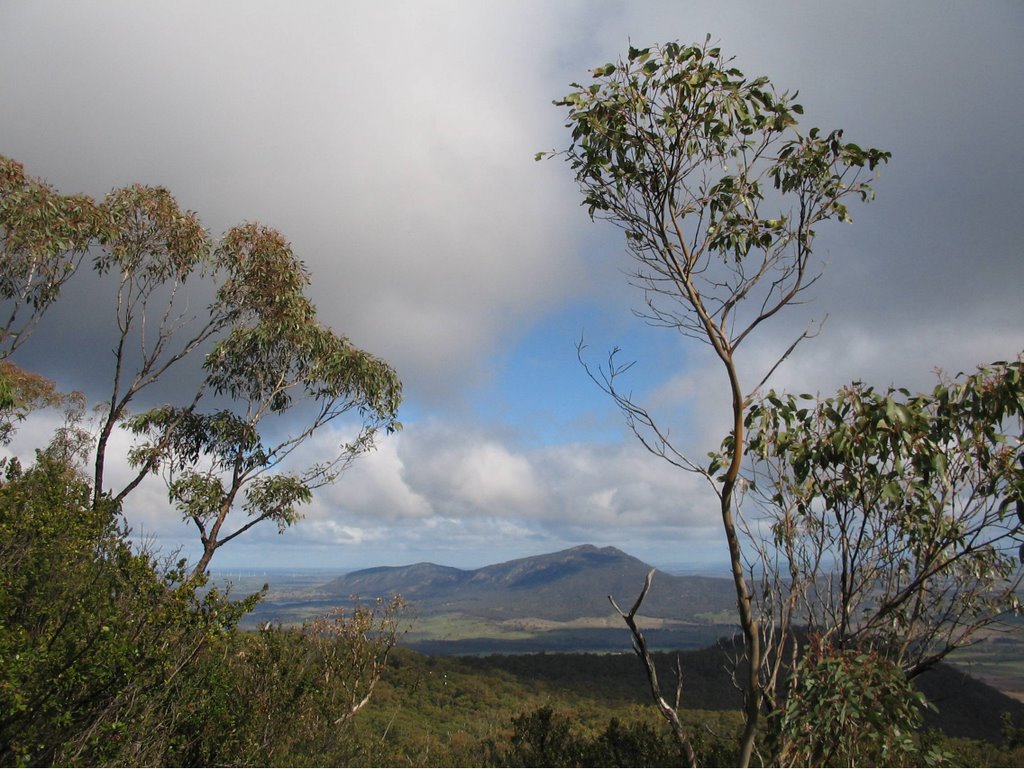
Panorama across Mt Langi Ghiran
On July 29, 2006, Mick and I went out to the Mt.Cole State Forest, 180 km west of Melbourne.
We parked the car at the Chinaman Picnic Ground, near the small settlement of Mt. Cole, then walked to the Ben Nevis Summit.
Our starting altitude was 440 m, and the summit was 880 m!
The first 2 km was along the gated management TelephoneTrack, a horribly steep punishment route up a sustained 1:4 gradient, with very few " recovery" stops!
This thing eventually flattened out after reaching the junction with the Eversley-Sugarloaf Track, which we followed until hitting the main Ben Nevis Rd. We followed this all the way to the Summit, crossing Shaldars Track and Red Rock Track.
We had originally planned to do the Borella Walk, which is supposed to be 10 km return from the Chinaman Picnic Ground to the Summit. We found the Borella Walk signpost near the Picnic Ground, but it was pointing into the bush, with no actual track to be seen! So we went up the Telephone Track, which we now believe may have been the first sector of the Borella Walk.
We found one solitary yellow track marker on a tree on the Eversley-Sugarloaf Track but could not find any recognizable foot-track.
At the summit picnic area, we found another signpost for the Borella Walk, and the track was visible, disappearing down the mountainside into the forest. We will go back there on another trip, driving to the summit this time, and find out more about the Borella Track and visit the Red Rock lookout!
The rewards for that punishing ascent up nearly 500 m were superb views across the Western Plains, with twin-coned Mt. Langi Ghiran nearby.
We have done all of the walking tracks up Mt. Langi Ghiran, and this view of it was intriguing, clearly showing the volcanic twin-cones, which are readily apparent when seen from other directions.
The summit has a Picnic Area and wooden shelter hut - it snows there in mid-winter!
There are two large radio-communications towers and equipment rooms at the summit, and a small bronze plaque, placed on a boulder there in 2002, marks the spot where an aircraft crashed in 1942, whilst flying from Rainbow to Ballarat.
The photo album of our adventure is at
http://www.worldisround.com/articles/307624/index.html
No comments:
Post a Comment