Rotating Headlines
Join this Weblog!
To become a Follower of this Weblog.
Click on the "Follow" link, underneath the list of current followers. You will be taken to an information panel where you may enter your personal details and other information. When completed, the title of this Weblog will appear in the Reading List on your Blogger Dashboard, and your Profile Picture will be displayed next to other Followers!
Click on the "Follow" link, underneath the list of current followers. You will be taken to an information panel where you may enter your personal details and other information. When completed, the title of this Weblog will appear in the Reading List on your Blogger Dashboard, and your Profile Picture will be displayed next to other Followers!
Followers to my Weblog!
Friday, September 10, 2010
Exploring Watermill Track, Kurth Kiln Park
Watermill Track is a gated management road in the Kurth Kiln Regional Park, 65 km east of Melbourne.
I explored this 4 km (return) scenic track on Thursday afternoon September 9, 2010, starting at the Beenak Rd.
The track follows the McCrae Creek Gully, reaching a cleared space which is understood to be the site of a former timber mill.
A short foottrack leads to the creek, which originates high up at the Shiprock Falls.
There is a change in elevation from 281 m to 225 m.
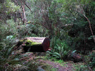
The Photos shows the scenery, track, environment, and creek. I have included images of the Blue Range, taken from Beenak Rd, which show the Mt Beenak Communications/Fire Tower.
Labels:
kurth kiln park
Location:
Beenak Rd, VIC 3139, Australia
Subscribe to:
Post Comments (Atom)


No comments:
Post a Comment