Rotating Headlines from this Weblog! Click to view Post!

Rotating Headlines

Join this Weblog!

To become a Follower of this Weblog.
Click on the "Follow" link, underneath the list of current followers. You will be taken to an information panel where you may enter your personal details and other information. When completed, the title of this Weblog will appear in the Reading List on your Blogger Dashboard, and your Profile Picture will be displayed next to other Followers!

Followers to my Weblog!

Showing posts with label kurth kiln park. Show all posts

Monday, May 07, 2012

Kurth Kiln Regional Park - Shepherd's Creek Hike


Pix taken on May 5 2012 on  a 3 km (return) hike in the Shepherd's Creek Gully, Kurth Kiln Regional Park, 80 km east of Melbourne.


The walk started at the junction of Shepherd's Creek Road and Shortcut Track.


The creek was flowing strongly, after recent heavy rains, and this section of the Park is very lush and green, with many tree ferns.


See all of the Photos of my visit!

Monday, January 30, 2012

Shiprock Falls in summer, Kurth Kiln Regional Park


The Shiprock Falls Reserve is in the northern section of the Kurth Kiln Regional Park, 65 km east of Melbourne, and 7 km from the town of Gembrook.

The McCrae Creek flows through the Reserve, and the falls cascade down from rock cliffs and past huge granite boulders.

I visited the Reserve on January 28, 2012, exploring 1 km of walking tracks, with good views of the falls.

See all of the Photos of my visit, and check out my YouTube video!

Sunday, January 29, 2012

Thornton Track in summer, Kurth Kiln Park


The Kurth Kiln Park is a large area of preserved forest, 70 km east of Melbourne, adjacent to the Bunyip State Park, north of the town of Gembrook.

It includes the historical Kiln, used in the 1940s for the manufacture of charcoal.

The Tomahawk Creek runs through the park - the main walking trail is the 3 km (return) Thornton Track.

I visited the Park on January 28, 2012, exploring the Thornton Track, starting at the main picnic ground, then leading into Scout Camp Track and Soldier's Rd.

See all of the Photos of my visit, and check out my YouTube video!


Tuesday, March 15, 2011

Thornton Walking Track in autumn - Kurth Kiln Park

The Kurth Kiln Park is a large area of preserved forest, 70 km east of Melbourne, adjacent to the Bunyip State Park, north of the town of Gembrook.

It includes the historical Kiln, used in the 1940s for the manufacture of charcoal.

The Tomahawk Creek runs through the park - the main walking trail is the 3 km (return) Thornton Track.

I visited the Park on March 14, 2011, exploring the Thornton Track, starting at the main picnic ground, then leading into Scout Camp Track and Soldier's Rd.

Many of the tracks are also popular with horseriders.


The photos include some shots of the Kiln and outbuildings.

See the Video and Slideshow

Thursday, January 20, 2011

Exploring the Shiprock Falls, Kurth Kiln Park


The Shiprock Falls Reserve is in the northern section of the Kurth Kiln Regional Park, 65 km east of Melbourne, and 7 km from the town of Gembrook.

The McCrae Creek flows through the Reserve, and the falls cascade down from rock cliffs and past huge granite boulders.

I visited the Reserve on January 19, 2011, exploring 1 km of walking tracks, with good views of the falls.

See all of the Photos of the Falls!

Friday, September 10, 2010

Exploring Watermill Track, Kurth Kiln Park


Watermill Track is a gated management road in the Kurth Kiln Regional Park, 65 km east of Melbourne.

I explored this 4 km (return) scenic track on Thursday afternoon September 9, 2010, starting at the Beenak Rd.

The track follows the McCrae Creek Gully, reaching a cleared space which is understood to be the site of a former timber mill.

A short foottrack leads to the creek, which originates high up at the Shiprock Falls.

There is a change in elevation from 281 m to 225 m.

The Photos shows the scenery, track, environment, and creek. I have included images of the Blue Range, taken from Beenak Rd, which show the Mt Beenak Communications/Fire Tower.

Tuesday, July 13, 2010

Kurth Kiln Historical Reserve


On Monday afternoon July 12, 2010 I visited the Kurth Kiln Park, 10 km north of the town of Gembrook.

The following information is acknowledged to the Kurth Kiln Friends Website:

http://home.vicnet.net.au/~fofkk/The%20Kurth%20Kiln%20Friends.htm:

The Park is named after Ernest E. Kurth, a Doctor of Chemistry at the time at the University of Hobart, who in 1940 was investigating alternate sources of motor fuel (such as shale and wood) for the eventuality that Australia could become cut off from the supply of overseas petrol.

Kurth soon realised that mineral shale oil, while theoretically possible, would of needs be a huge project, a complete new industry, needing massive funding, whereas charcoal production was already well established and the principle of wood-gas generation for motor vehicles universally known.

So he concentrated his efforts on ways to produce charcoal in the quantities required for such an application. He came up with a revolutionary new design for a continuous operation charcoal kiln, a vertical structure where new wood was added at the top and charcoal was extracted at the bottom; none stop, twenty-four hours a day, seven days a week.

The temperature of the charring process, besides being regulated with air vents, was carefully controlled by water, reticulated in a series of pipes through the hot charcoal.

Kurth's patented design won Federal Government approval and in 1941 he received funding for a full-scale production model. He chose the present location, some 10km north of Gembrook, where waste wood left over from the 1939 bushfires was plentiful.

In a trial production run starting 18 March 1942 some 500 tons of charcoal were produced by August that year; three tons every 24 hours from 21 tons of wood, the loading capacity of the kiln.

The process proved to be faster, less labour intensive than any conventional method, was 15% more efficient in yield and produced consistent high quality charcoal, free from contamination. The charcoal was graded and bagged on site before being shipped to distribution points in Melbourne.

Statistics show that some 60,000 vehicles were fitted with the so-called charcoal Gas Producers during the war years to give industry and the public the mobility to live with petrol rationing.

In February 1946 the kiln was de-commissioned and the Forestry Commission Victoria started using the site as a base camp for its forest management activities. Some 18 huts were purchased from the Army and used to accommodate the workforce, at times up to 100 men.

In 1982, after the FCV had moved out, Kurth Kiln was developed as a Picnic Ground. Material left over, after a fire destroyed most of the huts, was used to create a Caretakers Residence compound, where visitors now can see some of the historic settings and cultural artefacts from the period. The kiln itself, a monumental 10m high red brick and steel structure has, together with its associated sheds, become a landmark at the centre of the 3,500ha Kurth Kiln Park.

Although no precise figures are available it is predicted that some 10,000 visitors come to Kurth Kiln annually.

See all of the Photos of my visit!

Tomahawk Creek Walking Track, Kurth Kiln Regional Park


Tomahawk Creek Walking Track, 4 km circuit, is in the Kurth Kiln State Park, 65 km east of Melbourne.

Starting at the Kurth Kiln Picnic Ground, it passes through lush green fern gullies, tall forest, and along the banks of the Tomahawk Creek.

There are many unusual large rock formations, a bridge, and an interesting Gorge and waterfalls.

The historical Kiln, outbuildings and large dam are nearby.

Another circuit trail starts at the Picnic Ground, known as the Thornton Track.

My visit was on Monday afternoon July 12, 2010.

See my Photo Album which shows the scenery, bridge, the Track, Information Board, the creek, the gorge, winter wildflowers, beautiful fungi, and the waterfalls.

Shiprock Falls, Kurth Kiln Regional Park


The Shiprock Falls Reserve is in the northern section of the Kurth Kiln Regiolnal Park, 65 km east of Melbourne, and 7 km from the town of Gembrook.

The McCrae Creek flows through the Reserve, and the falls cascade down from rock cliffs and past huge granite boulders.

I visited the Reserve on Monday afternoon July 12, 2010, exploring 1 km of walking tracks, with good views of the falls.

See all of the Photos of my visit!

Wednesday, February 03, 2010

Tomahawk Creek Walking Track, Kurth Kiln Park


Tomahawk Creek Walking Track, 4 km, is in the Kurth Kiln State Park, 65 km east of Melbourne.

Starting at the Kurth Kiln Picnic Ground, it passes through lush green fern gullies, tall forest, and along the banks of the Creek.

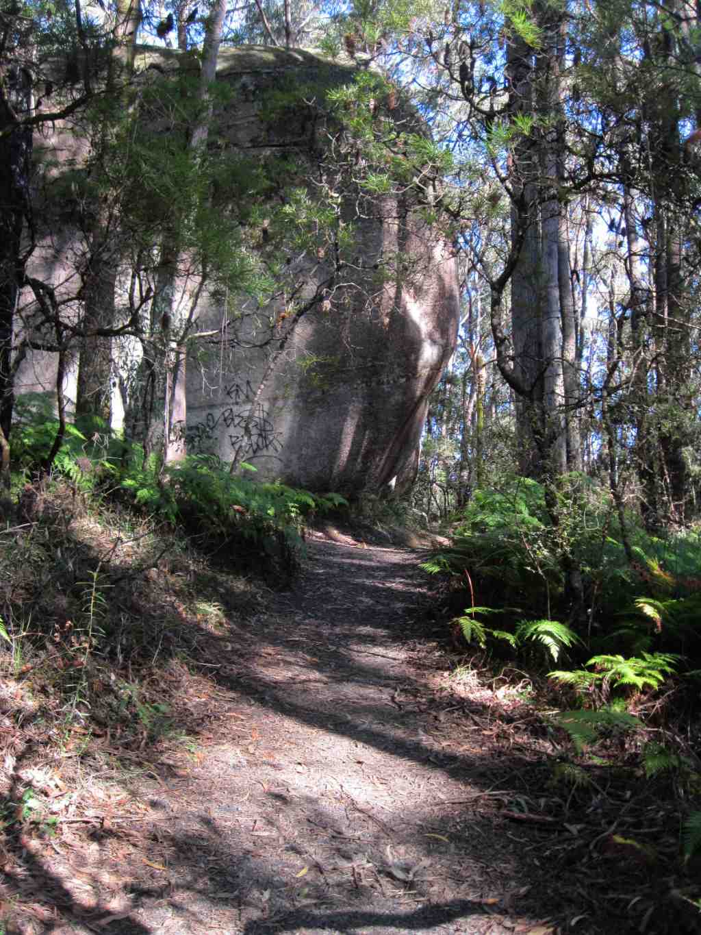
There are many unusual large rock formations and an interesting Gorge and waterfalls.

The historical Kiln, outbuildings and large dam are nearby

My visit was on February 1, 2010, a very hot day!

See all of the Photos of my visit!

Tuesday, September 15, 2009

Kurth Kiln Park - Possum Track in Spring


The Possum Track is in the north-west section of the Kurth Kiln Park, 70 km east of Melbourne. It links Beenak Rd and Monkhouse Track, and follows the beautiful ferns in the Possum Creek Gully.

A large lake, surrounded by tall forest, was discovered at the northern end of the track!

I hiked this Tk, 4 km return, on September 14, 2009, with some sections being thick red mud, after the recent rains!

The highest altitude reached on the Tk was 278 m - the lowest was 222 m.

It is not far from the historic Kiln.


See all of the
Photos of my visit!

Sunday, August 16, 2009

Waterchannel Track - Kurth Kiln Park


Waterchannel Track is in the Kurth Kiln Park, about 65 east of Melbourne, near the town of Gembrook.

It links Scout Camp Track with the Gembrook-Launching Place Rd, and remains of the old water channel may be seen in bushland off the track.

The Track passes through dense bushland and stands of orange Banksia.

The origin and construction date of the water channel are not known.

The Track crosses a fireline/firebreak and a water point on an old dried-up watercourse which runs into the Tomahawk Creek.

Overgrown foot tracks branch off from the main track, which are best ignored, which lead back through the forest to nearby Soldiers Rd.

The area was once heavily logged from the late 1890s, but timber cutting ceased in 1990 across this Park and neighbouring Bunyip State Park.

I explored this interesting track on Friday afternoon August 14, 2009, about 3 km return, starting at the gate at Scout Camp Track, not far from the Kurth Kiln Picnic area.

The Track is shared with walkers, cyclists and horseriders.

There are good views from nearby Beenak Rd across farmlands towards Mt Beenak, Egg Rock, the Yarra Ranges and the Bunyip State Park.

See the full set of
Photos of my visit!

Tuesday, August 04, 2009

Kurth Kiln Park - the Thorton WalkingTrack


The Kurth Kiln Park is a large area of preserved forest, 70 km east of Melbourne, adjacent to the Bunyip State Park, north of the town of Gembrook.

It includes the historical Kiln, used in the 1940s for the manufacture of charcoal.

The Tomahawk Creek runs through the park - the main walking trail is the 3 km (return) Thornton Track.

I visited the Park on August 3, 2009, exploring the Thornton Track, starting at the main picnic ground, then leading into Scout Camp Track and Soldier's Rd.

See the full set of Photos of my trip!

Monday, March 16, 2009

Tomahawak Creek Track - Kurth Kiln Park


Tomahawk Creek Walking Track, 4 km, is in the Kurth Kiln State Park, 65 km east of Melbourne.

Starting at the Kurth Kiln Picnic Ground, it passes through lush green fern gullies, tall forest, and along the banks of the Creek.

There are many unusual large rock formations and an interesting Gorge and waterfalls.

The historical Kiln, outbuildings and large dam are nearby.

My visit was on March 14, 2009.

See the complete set of
Photos of my trip!