Rotating Headlines from this Weblog! Click to view Post!

Rotating Headlines

Join this Weblog!

To become a Follower of this Weblog.
Click on the "Follow" link, underneath the list of current followers. You will be taken to an information panel where you may enter your personal details and other information. When completed, the title of this Weblog will appear in the Reading List on your Blogger Dashboard, and your Profile Picture will be displayed next to other Followers!

Followers to my Weblog!

Showing posts with label forest. Show all posts

Sunday, May 20, 2012

Mortimer Nature Trail - Bunyip State Park

These pix were taken on May 20 3012.


They show the scenery and environment along the 2 km Mortimer Nature Trail, Bunyip State Park, 70 km east of Melbourne.

The circuit trail started at the Gembrook-Tonimbuk Rd, snd crossed the Diamond and Wallace Creeks.

Information signs along the Track describe points of interest.

See the Slideshows, below! Animoto is an animated video, 30 secs duration.


Enjoy!


Make your own slide show at Animoto.

Sunday, April 08, 2012

Tomahawk Creek Walking Track - Kurth Kiln Regional Park


These pix were taken on April 7  2012, in the Kurth Kiln Regional Park, 65 km east of Melbourne.


They show the scenery and environment along the 3 km (return) Tomahawk Creek Walking Track, which follows the Tomahawk Creek to Shepherd's Creek Rd.


This track passes through stands of lush ferns, and can be slippery in places.


See the complete set of Photos of my visit, and my YouTube video!


Monday, January 30, 2012

Shiprock Falls in summer, Kurth Kiln Regional Park


The Shiprock Falls Reserve is in the northern section of the Kurth Kiln Regional Park, 65 km east of Melbourne, and 7 km from the town of Gembrook.

The McCrae Creek flows through the Reserve, and the falls cascade down from rock cliffs and past huge granite boulders.

I visited the Reserve on January 28, 2012, exploring 1 km of walking tracks, with good views of the falls.

See all of the Photos of my visit, and check out my YouTube video!

Sunday, January 29, 2012

Thornton Track in summer, Kurth Kiln Park


The Kurth Kiln Park is a large area of preserved forest, 70 km east of Melbourne, adjacent to the Bunyip State Park, north of the town of Gembrook.

It includes the historical Kiln, used in the 1940s for the manufacture of charcoal.

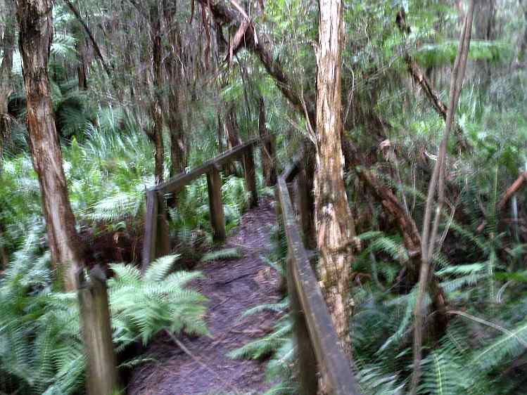
The Tomahawk Creek runs through the park - the main walking trail is the 3 km (return) Thornton Track.

I visited the Park on January 28, 2012, exploring the Thornton Track, starting at the main picnic ground, then leading into Scout Camp Track and Soldier's Rd.

See all of the Photos of my visit, and check out my YouTube video!


Wednesday, April 15, 2009

Mount Worth State Park


Mount Worth State Park, about 125 km SE of Melbourne, takes in 1040 hectares of natural forest, regenerating native bush and cleared pastures in the western Strzelecki Ranges, south-east of Warragul.

A network of walking tracks radiate from the Moonlight Creek Picnic area. These include the Giant's Circuit 1.8 km, Moonlight Curcuit 8.5 km, Gardiner's Mill Track 1.5 km one way, Maslin's Mill 800 m one way.

In the 1920s, 12 timber mills were operating in the region - all that remains are sawdust heaps and rusting machinery.

I visited the Park on Easter Monday April 13 2009, reaching it via Darnum and the Allambee Estate Rd.

There were spectacular views to the north across pine plantations over the Latrobe Valley to the Baw Baw Ranges.

I explored about 4 km of walking tracks.

Visitor Guides are available at the Information Kiosk at the picnic ground.

See the full set of Photos of my visit!

For further information, see Parks Victoria at

Wednesday, February 25, 2009

Fiddler's Gully - Warrandyte State Park


Fiddler's Gully was once the centre of frenzied goldmining in the 1850s, in what is now the Warrandyte State Park, 30 km east of the Melbourne CBD.

An interesting 4 km circuit hike starts at the small car park/picnic area on Gold Memorial Rd, ascending Wildcat Gully Track, into Wildcat Link Track, then along public access Webb Rd, and on to Fiddler's Gully Track.

Fiddler's Gully Track descends steeply past old gold mining relics and rejoins Webb Rd, then into Wildcat Link and back to the start.

My hike was on February 25, 2009, a grey and overcast day.

See the full set of Photos of my trip!

Sunday, February 22, 2009

Exploring the Olinda Falls in mid-summer


The Olinda Falls are among the most popular attractions in the Dandenong Ranges National Park, 30 km from the Melbourne CBD.

There are actully three falls - the upper, middle and lower cascades, with viewing areas for each along the 1 km steep track which starts at the picnic ground on Falls Rd.

Visitors have enjoyed the Falls since the 1860s, well before motor cars made their appearance in Melbourne, when they travelled up Mt Dandenong by horse and buggy!

The Falls were originally known as the "Valinda Falls", the name of the district, which then became "Olinda".

Olinda settlement is perched on the rim of the ancient volcano crater, which last erupted 200 million years ago!

Please see my Photo Album of the trip, which shows the walking track, signposts to nearby trails, the falls, the picnic ground, the car park, and the viewing platforms. It includes two archival photographs, showing the Falls Walking Track, and what the Falls looked like around the year 1910.

I visited the
Olinda Falls on February 20, 2009.

The Track to Lookout Rock, Olinda


One of the best walks in the Olinda Section of the Dandenong Ranges National Park is to the Lookout Rock.

I visited this interesting geographical feature on February 21, 2009. My 4.5 km return route was along gated Mathias Rd, starting at the junction with Falls Rd, then into Golf Course Track and to the Rock.

There are glorious views from Golf Course Track and Mathias Rd across the Upper Yarra Valley to the Yarra Ranges.

The Rock, adjacent to the Olinda Golf Course, has been a favourite destination for walkers since the early 1900s. In those years, there were good panoramas from the Rock, but these are now obscured by tall timber regrowth.

The Hamer Arboretum borders Mathias Rd.

See the
Photos of my trip, which include two historical images of the Rock as it was in the year 1910!

Monday, February 16, 2009

Hermon's Track - Olinda Forest


Hermon's Track is a popular 3 km walking/cycling/equestrian trail in the Olinda Forest, Dandenong Ranges National Park, 35km east of the Melbourne CBD.

It is reached from the Eagle Nest picnic ground, off Silvan Rd, and follows the Lyrebird Creek valley.

It passes through regrowth forest, fern gullies, and across the creek, with cockatoos screeching overhead!

My visit was on February 15, 2009.

See the full set of
Photos, which include some images taken at the nearby Woolrich Lookout, looking east towards the ranges around Gembrook, where bushfires were still burning in the Bunyip State Park.

Sunday, February 15, 2009

Gurdies Bushland Reserve and Lookout


The Gurdies, represents some of the largest remaining areas of native vegetation on the eastern shore of Western Port and covers an area of about 260 hectares.

In 1798, Western Port and Bass Strait were discovered by George Bass and a volunteer crew, who sailed and rowed from Port Jackson in an open whaleboat. Many features of the local area have been named after George Bass, such as the Bass Highway, the township of Bass, the Bass Ranges and the Bass River. During the 1800s Western Port was a very busy harbour and areas such as Corinella and Grantville were settled. Also during the 1800s, many of the grand eucalypts of the ranges such as Messmate and Bluegum (some 70 metres in height), were felled and used in the construction of wharves, railway bridges and railway lines.

In 1977, the Gurdies bushland area was recognised as significant in terms of its flora and fauna values and in 1992 the area was was proclaimed a Flora and Fauna Reserve.

The main entrance to the Reserve is at the car park, picnic area, and information kiosk, located on the Bass Highway, about 80 km SE of Melbourne, 12 km south-east of its intersection with the South Gippsland Highway.

The signposted walk starts here, initially passing through bushland, then joining a wide management track. This track is followed up a gentle gradient, through regrowth forest, eventually reaching the Lookout picnic area, adjacent to cleared private property at the end of Dunbabbar Rd.

There is a spectacular view across Westernport, and an information board describes the history of Westernport.

There is a rise in altitude from 41 m to 123 m.

The return descent to the car park is along the same route - a side trip can be made to the nearby quarry if desired.

There are several other tracks in the Reserve, offering alternative routes to and from the Bass Highway - these are well signposted with distances shown.

Nearby is the settlement of Grantville, and a visit to the jetty is worthwhile, just off the Bass Highway, with good views across Westernport to French Island and the mountains to the north.

My visit was on February 14, 2009 - walking distance was about 5 km total.

For further information, see the Track Notes/Map from Parks Victoria, at
http://www.parkweb.vic.gov.au/resources05/05_2304.pdf

See the full set of Photos of my trip

Thursday, February 05, 2009

Ferres Walking Trail - Black Snake Range - Bunyip State Park


The Ferres Walking Trail is in the western section of the Black Snake Range, Bunyip State Park, about 60 km east of Melbourne.

It is reached from the Princes Highway, Tynong North Rd, Gembrook-Tonimbuk Rd, Link Rd, to a small car park at the eastern end of gated Silvertop Ridge Track. Follow this Track to a large Water Point - immediately opposite is the signed western access point to the Ferres Walking Trail.

This circuit is about 3 km, through regrowth forest, in an area formerly logged, and follows the Diamond Creek valley easterly back to the Silvertop Ridge Tk.

The Ferres Trail is rarely walked, and care is needed to avoid losing it, due to fallen bark, branches, trees, and leaf litter.

I did this circuit on February 4, 2009.

See the full set of
Photos

Wednesday, February 04, 2009

A Hike in the Olinda Forest


On Tuesday February 3, 2009, I explored a seldom visited un-named track in the Olinda Forest, Dandenong Ranges National Park.

This 2 km track starts at gated Road 13, just off the Olinda Creek rd, and winds its way through interesting forest, along the Olinda Creek valley, ending at Road 13 near the bridge.

This track is not shown on any maps, and is not signposted!

See the full set of Photos, which include some historical images of the forest taken in 1869 and 1910!

Sunday, January 25, 2009

Bald Hill Lookout - Bunyip State Park


The Bald Hill Lookout is in the Weatherhead Range, in the south-western section of the Bunyip State Park, about 60 km east of Melbourne.

It is off Lupton's Track, a gated management track which starts at the Tynong North Rd, some 9 km north of the Princes Highway.

Walkers, horseriders and cyclists are permitted to use this Track, which ultimately joins the Weatherhead Hill Track, several km further to the east.

The Lookout is at 254 m - the start of the track is at 194 m.

The views from the Lookout are outstanding, which I consider to be the best in this section of the Park.

There are magnificent panoramas north across the Diamond Creek valley to the spectacular and rugged Black Snake and Blue Ranges.

The lower section of the Track ascends through grassland and low scrub, then to forest and bushland. Past the Lookout, it continues along a ridge line, at about 291 m.

There are no signs indicating the existence of this marvellous lookout - a wooden seat is provided for a rest!

I visited this Lookout on January 24, 2009, a walk which was about 4 km return.

See the full set of
Photos in slideshow or static format!

Saturday, January 24, 2009

Exploring Avard's Track - Bunyip State Park


Avard's Track is in the SW section of the Bunyip State Park, 60 km east of Melbourne.

It is a gated management track, and links the unsealed Tynong North Rd with Lupton Track - walkers, horseriders and cyclists are permitted to use it.

It starts near the Cannibal Creek Track horse-unloading car park, about 8 km north of the Prince's Highway, and there is a rise in altitude from 144 m to the ridge-top at 320 m.

The track follows a spur into the Weatherhead Range, and passes through regrowth forest and bushland.

The ridgeline was devastated by an out-of-control backburn operation in 2007, and the blackened trees and stumps are a stark reminder of this fire, which destroyed a large part of the Park.

There are limited views from the ridgeline south towards Mt Weatherhead and adjacent farms.

West views from the lower part of the track are towards Sandpit Ridge, and north to Bald Hill.

This track is steep in parts, dry and dusty, and sufficient drinking water should be carried, especially on hot days.

See the full set of
Photos of my expedition!

Wednesday, January 21, 2009

Olinda Creek Track, Dandenong Ranges NP


The Olinda Creek Track is a 3 km circuit route, starting at the junction of gated Road 13, reached from a small car park on the Olinda Creek Rd.

It passes through good forest and beautiful ferns and tree-ferns on its way to the Olinda Creek.

There is a signpost at the junction with Road 13, and a side-track eventually comes out at the Olinda Creek Rd.

I explored this interesting track on January 20, 2009, a day of extreme heat, 40 degrees!

See the complete set of photos, and a map!

Sunday, January 11, 2009

The La La Falls and Four Mile Creek Weir - Warburton


The La La Falls are in the former timber cutting region, near the town of Warburton, 65 km east of Melbourne, in the Yarra State Forest.

A 3.5 km return walking track leads up to the Falls, through the dense jungle of the Four Mile Creek Gully.

The track is reached from Park Rd (opposite the Sanitarium Factory) along Old Warburton Rd to the start of the track on Irruka Rd (about 1 km from Warburton).

This track follows the alignment of a timber tramway built in 1909, which started at Woods Point Rd at the former La La rail siding. This tramway was used to carry logs from the lower reaches of the Mt Bride logging area, which couldn't be profitably worked from the Mt Bride Mill. The Mill closed down in 1916, and the tramway then became a popular walking track for visitors to Warburton, ending at the Falls.

As at 2009, no trace remains of the tramway, apart from old logs adjacent to the alignment. The area was devastated by bushfires in 1939.

A mill existed between 1909-1911 opposite the start of the present day walking track.

A small weir was built across Four Mile Creek in the 1940s, and its remains may be seen just off the track, about 200 m from the start. It is heavily overgrown, and a rusting barbed wire fence and iron gate marks its perimeter.

The Track is very slippery after heavy rain, and care is needed. Parts of it are rocky and steep, over steps and boardwalks, and it terminates at a viewing platform at the base of the Falls.

See my Photos of this trip of January 10, 2009, which show the Falls and the scenery along the Track, and some achival photos of the Falls as they looked in the early 1900s!

Monday, December 22, 2008

Sawpit Creek - Condon's Track, Healesville


Condon's Track is a 6.5 km walking route in the Yarra Ranges National Park, within the Maroondah Catchment area, 60 km east of Melbourne.

It links Donnelley's Weir Rd with Monda Rd, an increase in altitude of about 800 m.

The southern section of the Track is along Melbourne Water's Road 17, one of several forest management roads in the catchment area on which walkers are permitted.

The Track goes over the "Echo Tunnel", where the Maroondah Aqueduct begins, and crosses Sawpit Creek, through old logging forest. Large stumps are along the track, with horizontal saw cuts still visible.

I walked some of this Track on December 21, 2008, along Road 17, starting at the junction with Donnelley's Weir Rd (116 m altitude) and passing Sawpit Creek.

I then walked up the Maroondah Reservoir Track to the junction with Henderson Hill Track, with nice views to Mt Riddell, a total distance of about 4 km on a very hot day!

The history of the region is interesting. Construction of the Maroondah Reservoir started in 1891, and was completed in 1927. Logging was widespread in the forest until the Reservoir and Aqueducts were opened. Many of the former logging tracks were taken over by the Board of Works (now Melbourne Water), and walker access was prohibited.
Sawpit Weir was decommissioned in 1988.

In 1929, visitor facilities were built in what was known as "Condon's Gully Picnic Stop", described as "just off Condon's Gully Track", and it was said that access was by horse and coach from Healesville. This may be next to the Sawpit Weir, in the area where large pine trees now grow.

There are references to remains of these facilities existing in the early 1970s, but the exact location is unknown.

There is confusion with the old names "Condon's Gully Track" and "Condon's Track". It is posssible that these were one and the same!

Condon's Creek, and the Condon's Creek Gully, are further to the east. The prohibited-access section of Road 17 appears to be the original track to the Gully. East of Condon's Gully is the Meethinna Creek and Meethinna Falls. Road 17 is believed to be the original access to the Falls.

Images of the period 1880 to the early 1900s show the beautiful Falls, but historical references indicate that by 1915, walking access had become difficult, due to the tracks becoming overgrown by forest growth, and not being maintained. There has been no public access permitted to the Falls since about 1939.

It is generally known that the Maroondah Reservoir was formed by damming the Watts River. Condon's Creek and Matthinna Creek formerly entered the Watts River, at the base of Mt Monda. These creeks now flow into the Reservoir.

See the full set of Photos of my trip

Sunday, December 21, 2008

Lookout Rock - Olinda


One of the best walks in the Olinda Section of the Dandenong Ranges National Park is to the Lookout Rock.

I visited this interesting geographical feature on December 20, 2008. My 4.5 km route was along gated Mathias Rd, starting at the junction with Falls Rd, then into Golf Course Track and to the Rock.

My return route was back along Golf Course Track, then along Cornus Track, meeting Mathias Rd, and back to the start.

There are excellent views from Golf Course Track and Mathias Rd across the Upper Yarra Valley to the Yarra Ranges.

The Rock has been a favourite destination for walkers since the early 1900s, and is adjacent to the Olinda Golf Course.

In earlier years, there were good panoramas from the Rock, but these are now obscured by tall timber regrowth.

A lyrebird was seen crossing Mathias Rd!

The Hamer Arboretum borders Mathias Rd.

See the
Photos of my trip, which inclide some historical images of the Rock as it was in the year 1910!

Wednesday, December 17, 2008

Mt Pilot Lookout Walking Track, Chiltern-Mt Pilot National Park


The Mt Pilot Lookout Walking Track is a 1 km (return) climb in the Chiltern-Mt Pilot National Park, 275 km NE of Melbourne, south of the small town of Chiltern.

This large Park is 21,565 ha, and protects a vast forest which contains a diverse range of natural and historic landscapes.

It's a remnant of of a forest type (Box-Ironbark) which was once much more widespread in Victoria. It is made up of Grey Box, White Box, Red Box and Mugga Ironbark, as well as Red Stringybark and Blakeley's Redgum.

This forest originally consisted of large well-spaced trees and a grassy floor. The discovery of gold in 1858 resulted in destruction of many of the trees to supply timber for the mines and firewood for local people. Now, the vegetation is mainly regrowth and the trees are mostly young - less than 60 years old, straight and relatively close together.

The Lookout Track is reached from the Chiltern-Beechworth Rd, turning off at the Old Coach Rd, then to the Mt Pilot Summit Picnic Area car park. It is then a short walk to the Lookout up a formed track.

The Mt Pilot summit is at 545 m, with 360 degree views across the surrounding countryside, with Mt Buffalo clearly visible on the southern horizon.

A stone cairn is at the summit, showing distances to various mountain peaks.

Nearby is the fire spotting tower.

With friend Mick, I visited this spectacular Lookout on December 14, 2008.

See the full set of Photos of our trip