Rotating Headlines from this Weblog! Click to view Post!

Rotating Headlines

Join this Weblog!

To become a Follower of this Weblog.
Click on the "Follow" link, underneath the list of current followers. You will be taken to an information panel where you may enter your personal details and other information. When completed, the title of this Weblog will appear in the Reading List on your Blogger Dashboard, and your Profile Picture will be displayed next to other Followers!

Followers to my Weblog!

Showing posts with label melbourne. Show all posts

Thursday, March 15, 2012

The Yarra River Reserve, Chirnside Park


These pix were taken on March 23, 2012, on a 3 km hike through the Yarra River Reserve, Chirnside Park, 30 km east of central Melbourne.


My exploration started at the Lower Homestead Rd canoe launching ramp, then along the track throujgh the Reserve, adjacent to the perimeter of the Heritage Golf and Country Club and the scenic lake.
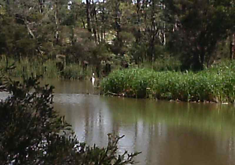

A pelican resides in the lake!


See the complete set of Photos of my visit, and the YouTube Video!

Saturday, April 18, 2009

Black Flat Trail - Warrandyte State Park


Black Flat Trail links the Jumping Creek Picnic Ground with the historical gold mining area of Black Flat.

It is in the Warrandyte State Park, 20 km east of the Melbourne CBD.

The Trail, 4 km return, follows the Yarra River Gorge for much of the way, passing through bushland and crossing Jumping Creek.

Some parts are steep and stony, and there are excellent views of the Yarra from the clifftop section.

This was my autumn visit, on Friday April 17, 2009.

See the complete set of Photos
of my visit!

Friday, April 10, 2009

Mt Lofty in Early Autumn


Mt Lofty is the highest point in the eastern section of the Warrandyte State Park, 25 km east of the Melbourne CBD.

On April 9, 2009, I visited the area, doing a 4 km return walk to the Mt Lofty Summit, starting at the gate to Stephen Track off Reserve Rd, reached from Jumping Creek Rd.

This walk took me up Stephen Track steeply to the summit, then along the ridge, to a turnaround point near the fire track.

The views from the summit are outstanding, easterly across the Upper Yarra Valley to the Yarra Ranges, and south to the Dandenong Ranges.

There is a picnic table and seat at the Summit, and an information board is nearby at the junction with Wayne Track.

See a map of the Warrandyte Region at

http://bonzle.com/c/a?a=sm&v=6GHCJP69CIT4

See the complete set of Photos of my visit!

Monday, March 30, 2009

Pound Bend Walk - Warrandyte State Park


On Sunday March 29 I visited the Warrandyte State Park, 20 km from the Melbourne CBD.

Leaving my car at the Pound Bend picnic ground, I walked through the forest along the main Pound Bend Track, reaching the large open field managed by Parks Victoria.

Then, back to the car.

Several other people were on the Track, enjoying the beautiful views of the Yarra, and looking out for koalas!

This was a 4 km return walk - sadly, no koalas were seen.

See the full set of Photos of this excursion!

Saturday, March 28, 2009

Exploring Burkes's Lookout, Mt Dandenong


On Friday March 27 2009 I went up to the Mt Dandenong summit region.

Leaving the car at the small car park off Ridge Rd, near the Kyeema aircrash memorial, I walked along Kyeema Track to the superb open rocky viewpoint known as Burke's Lookout. This is adjacent to the ABV2, HSV7, and Channel Ten TV towers.

From there, I continued to the Mt Corhanwarrabul Picnic area, then along Eyre Rd and into the scenic Singleton Bushland Reserve. A walking track in the Reserve offers good views to the east through a cleared area of forest.

Then, back to the car, after a journey of about 3 km.

The panoramas from Burke's Lookout across Melbourne are excellent - the city skyline, Port Phillip Bay and the You Yangs further to the west were visible. To the north, the Macedon and Kinglake Ranges are prominent, but there was some haze.

A new memorial cairn and information board have recently been constructed near the site of the Kyeema aircrash disaster of October 1938.

See the full set of Photos of this trip.

Sunday, March 22, 2009

Gunnamatta Coastal Walk


The Gunnamatta Surf Beach is about 90 km south of Melbourne, in the Mornington Peninsula National Park.

I visited the Beach on March 21, 2009, on a 5 km (return) beachwalk to the southeast, reaching the rocks at the base of the rugged cliffs near Fingal.

The surf was up, with big waves, and the Surf Patrol was vigilant!

The main walking track from Gunamatta to Cape Schank follows the beach along the sand dunes, for about 1 km, where it then veers inland and continues along the cliff top, passing the turn-off to Fingal Beach.

The coastal views towards the Cape Schank Lighthouse were spectacular!

Note that there is an admission fee of $4.40 per car.

My
Photos show the scenery, surf, dunes, fishing, swimmers, waves, beach and cliffs with some "candid camera" shots!

Tuesday, March 17, 2009

East Warburton River Trail


The Yarra River is adjacent to the small settlement of East Warburton, about 70 km east of Melbourne.

There is a pleasant walking track of about 1 km from a car park on the Wood's Point Rd, at the Riverside Drive junction.

The large cleared space opposite the car park, now used for grazing cattle, was once part of the Warburton Steam Railway, which hauled logs from Big Pat's Creek in the early 1900s to the Warburton rail head.

My visit was on March 16, 2009.

See the Photos of my visit

Saturday, March 14, 2009

Hardy Gully Nature Trail - Kallista


On March 14 2009 I visited Grant's Picnic Ground, Kallista, in the Dandenong Ranges National Park, about 35 km from the Melbourne CBD.

From there I walked some 3 km along the Lyrebird, Hardy's Gully, and Neumann Tracks, reaching my turnaround point at Wallaby Paddock.

This paddock was once a potato farm in the 1940s - no traces of any buildings remain, but parallel lines of furrows are still visible.

This was a cool and rainy day, bit this not deter the many parrots, galahs and white cockatoos who know where to go to get their seeds!

See the complete set of
Photos of my trip!

Thursday, March 05, 2009

Exploring Yarra Brae - Warrandyte State Park


On Wednesday March 4, 2009, I visited the remote Yarra Brae Section of the Warrandyte State Park, 20 km east of the Melbourne CBD. I completed a 7 km return hike along the gated Market Garden and Lucerne Paddock Tracks, both being fire management tracks, starting and finishing at the Clifford Activity Centre, reached from Clifford Drive, off Jumping Creek Rd.

The State government purchased the Stane Brae and Yarra Brae river frontages in 1982 and both parcels of land were incorporated into the park in 1987.

This is one of the best long walks in the Park, with excellent views easterly over the Yarra Gorge towards the Yarra Ranges and the Mt Lofty section of the Park.

Market Garden Track starts at the Clifford Activity Centre. Just north of signed Scout Track is a short side-track leading up to a large cleared space on a hilltop - there are good views from here to the Kinglake Ranges and hills around Kangaroo Ground, and across neighbouring farms, grazing properties, and equestrian centres.

Market Garden Track then descends to a large clearing next to the Yarra River, believed to be the site of an early farm. This is a Water Point for fire management puerposes. Immediately opposite this point is the small municipality "Bend of Islands", an Environmental Living Zone.
From this spot, a gate marks the start of unsigned Lucerne Paddock Track, which follows the river, until another large cleared area is reached. This is another Water Point for fire protection purposes.

From here, it is a 3 km trudge back to the start, mindful that there is an increase in altitude fromn 50 m to 130 m!

Market Garden and Lucerne Paddock Tks form the "Bridle Trail", popular with horseriders.

Yarra Brae was one of the original grazing properties, acquired by the Hon. L. Clifford in 1940. After being a war-time army training area, Clifford made it available for Australia's first Pan Pacific Scout Jamboree in 1948.

Clifford Park, now owned and managed by Scouting Victoria, also hosted jamborees during the 1950s and is available for conferences, meetings, conventions, school groups, education and activity-based camps.

In 1972 Yarra Brae was the site of a proposed lower Yarra River reservoir, but residents of Bend of Isles persuaded the Victorian Government to abandon the proposal. The allied Sugarloaf Reservoir at Christmas Hills went ahead.

The Tracks are shared with walkers and horseriders, and are steep and rocky in parts. During summer, it can be fiercely hot and dry, and caution is advised.

I have also included a photo taken in 1942 which showed "Yarra Brae Homestead" and outbuildings as they existed at the time. The Homestead is still there, located on the top of the hill, originally reached from a sealed access road, now closed off, which can be seen leading off from Market Garden Track.

See the full set of Photos of this trip!

Saturday, February 28, 2009

Yarra River Reserve at Warrandyte


I visited the Warrandyte State Park, 25 km east of the Melbourne CBD, on February 27, 2009.

This was a 5 km return walk along the Yarra River Reserve, centred on the Taroona Reserve picnic ground, which took me from the western end of Everard Drive to the main bridge in the centre of town.

See the full set of
Photos, which show the river, scenery, people having a good time, many hounds, some ducks, and young climbers on the steep cliffs.

It was a hot day, 35 degrees!

Wednesday, February 25, 2009

Fiddler's Gully - Warrandyte State Park


Fiddler's Gully was once the centre of frenzied goldmining in the 1850s, in what is now the Warrandyte State Park, 30 km east of the Melbourne CBD.

An interesting 4 km circuit hike starts at the small car park/picnic area on Gold Memorial Rd, ascending Wildcat Gully Track, into Wildcat Link Track, then along public access Webb Rd, and on to Fiddler's Gully Track.

Fiddler's Gully Track descends steeply past old gold mining relics and rejoins Webb Rd, then into Wildcat Link and back to the start.

My hike was on February 25, 2009, a grey and overcast day.

See the full set of Photos of my trip!

Silvan Reservoir Park


The Silvan Reservoir Park is adjacent to the Silvan Reservoir, 40 km east of the Melbourne CBD.

The Reservoir supplies water via large underground pipelines to storage facilities nearer to the city.

The Park incorporates a beautiful and carefully maintained picnic ground, as well as several interesting walking tracks.

The Reservoir was built in the period 1928-1931, and some artifacts from the original construction have been preserved, including part of the former concrete aqueduct and the Stilling Basin.

The Stonyford Creek Nature Trail, which starts at the picnic ground, is a short, 1 km circuit walk through protected forest and fern gullies.

I visited the Park on February 24, 2009.

See the full set of
Photos of my trip!

Comprehensive information about the history and development of the Reservoir may be found at
http://www.aussieheritage.com.au/listings2/vic/Silvan/SilvanReservoirandPark/18279

Mt Lofty Summit - Warrandyte State Park


On February 23, 2009, I completed a pleasant 3 km circuit walk in the Mt Lofty section of the Warrandyte State Park, 30 km east of the Melbourne CBD.

My route started at the Park gate on Lower Homestead Rd, in the municipality of Wonga Park, just before the canoe launching ramp on the Yarra River.

This took me up Stephen Track, passing the information board near the Mt Lofty Summit, then a descent to the Yarra, at the Water Point.

There are picnic tables at the Summit and the Water Point.

From there, I followed the somewhat overgrown foot-track next to the Yarra to the canoe ramp, passing the lookout, along a boardwalk, and then back to Stephen Rd.

This walk is one of the best in the Park, with superb views in all directions from the Summit, looking across the Yarra gorges to the Yarra Ranges, the Dandenong Ranges, and the Kinglake Ranges.

New signposts have recently been built near the Summit.

Mt Lofty overlooks the adjacent large Heritage Golf and Country Club and the Wetlands.

See all of the Photos of my trip!

Monday, February 23, 2009

Gunnamatta Beach - scenic Coastal Walk


Gunnamatta Beach is a popular destination in the Mornington Peninsula National Park, about 80 km south of Melbourne.

I visited this magnificent ocean beach on February 22 2009, on a 4 km (return) coastal walk west to St Andrew's Beach.

The tide was out, exposing a vast array of rock pools.

The surf was up, with big waves!

The coastal vews were superb, with Cape Schank and the Lighthouse to the east, and the long sweeping beaches to Point Nepean to the west.

The Beach is at the end of Trueman's Rd, turn off from the Point Nepean Rd at Tootgarook.

An admission fee of $4.40 per car is charged for entry.

See the full set of
Photos of my visit!

Sunday, February 22, 2009

Exploring the Olinda Falls in mid-summer


The Olinda Falls are among the most popular attractions in the Dandenong Ranges National Park, 30 km from the Melbourne CBD.

There are actully three falls - the upper, middle and lower cascades, with viewing areas for each along the 1 km steep track which starts at the picnic ground on Falls Rd.

Visitors have enjoyed the Falls since the 1860s, well before motor cars made their appearance in Melbourne, when they travelled up Mt Dandenong by horse and buggy!

The Falls were originally known as the "Valinda Falls", the name of the district, which then became "Olinda".

Olinda settlement is perched on the rim of the ancient volcano crater, which last erupted 200 million years ago!

Please see my Photo Album of the trip, which shows the walking track, signposts to nearby trails, the falls, the picnic ground, the car park, and the viewing platforms. It includes two archival photographs, showing the Falls Walking Track, and what the Falls looked like around the year 1910.

I visited the
Olinda Falls on February 20, 2009.

The Track to Lookout Rock, Olinda


One of the best walks in the Olinda Section of the Dandenong Ranges National Park is to the Lookout Rock.

I visited this interesting geographical feature on February 21, 2009. My 4.5 km return route was along gated Mathias Rd, starting at the junction with Falls Rd, then into Golf Course Track and to the Rock.

There are glorious views from Golf Course Track and Mathias Rd across the Upper Yarra Valley to the Yarra Ranges.

The Rock, adjacent to the Olinda Golf Course, has been a favourite destination for walkers since the early 1900s. In those years, there were good panoramas from the Rock, but these are now obscured by tall timber regrowth.

The Hamer Arboretum borders Mathias Rd.

See the
Photos of my trip, which include two historical images of the Rock as it was in the year 1910!

Thursday, February 19, 2009

A Hike in the Sherbooke Forest to the Falls


This album shows the scenery, wildlife and features in the Sherbrooke Forest, Dandenong Ranges National Park, about 30 km east of the Melbourne CBD.

I visited this timeless beautiful forest on February 18, 2009, starting at the Sherbrooke Picnic Ground, on a 3 km circuit hike along the Sherbrooke and O'Donohue's Tracks, passing the Falls.

Sadly, the Falls were only a trickle, due to the extended drought.

The rosellas will always entertain you!

See my
Photo Abum, of the trip, which includes an image of the Falls, as they looked around the year 1940.

Wednesday, February 18, 2009

Blue Tongue Bend - Warrandyte State Park


The Blue Tongue Bend walking track is in the Warrandyte State Park, 20 km east of the Melbourne CBD.

The 4 km (return) track starts at the Jumping Creek Picnic Ground, off Jumping Creek Rd, and follows the Yarra River, through the Gorge.

The track, stony and steep in sections, passes through bushland until it ends at a sign "Blue Tongue Bend", where there are rapids.

My visit was on February 17, 2009.

See the full set of
Photos of my trip!

Sunday, February 15, 2009

Exploring Pound Bend - Warrandyte State Park


Warrandyte, 20 km east of the Melbourne CBD, is the site of Victoria's first gold discovery. The find at Anderson's Creek by Louis Michel, in 1851, marked the start of the Victorian gold rush and an influx of people into the area. The approximate location of the site is marked by a cairn on Fourth Hill in the Warrandyte State Park.

Another major location of gold in Warrandyte and Melbourne was the Yarra River. All through Warrandyte the river shows signs of being exploited, a classic example is the tunnel at Pound Bend.

The Pound Bend Tunnel was created in 1870 by a goldmining company in order to divert the course of the Yarra River, thereby enabling the exploitation of the old riverbed. It is now a popular swimming spot.

The river was partially dammed at Pound Bend near Norman's Reserve at its eastern entrance and near Bob's wetlands at its western exit. Miners then blasted a 300m long tunnel through solid rock. The river was then fully dammed at the entrance and exit to the tunnel and water was diverted through 300m and out the other side leaving an astonishing 3.85 km of riverbed around Pound Bend exposed to the sun and the miners picks.

The Pound Bend Reserve is popular in summer. There are grassy areas for picnicking, a walking track along the river which supplies access to koalas and a variety of flora, toilets (including disabled facilities), information boards, canoeing, swimming and horseriding opportunities and a nature walk.

I visited this interesting historical place on February 12, 2009. This included a 4 km return hike along the main Walking Track next to the river along the river bank.

See the full set of Photos

Saturday, February 14, 2009

Gold Heritage Trail - Warrandyte State Park


The 2 km Gold Heritage Trail is in the Warrandyte State park, 20 km east of the Melbourne CBD.

It passes several historical features, with interpretative signs describing the gold rush mining activities of the 1850s.

It is a loop circuit, reached from the Gold Memorial Rd carpark/picnic area, crossing Anderson's Creek, then along gated Wildcat Gully Track, ascending the summit of Fourth Hill. It then continues along Johnson's Track, and descends back to the car park.

From the ridgeline, there are limited views through forest towards the Dandenong Ranges.

I explored this interesting Trail on February 6, 2009.

See the full set of Photos