Rotating Headlines from this Weblog! Click to view Post!

Rotating Headlines

Join this Weblog!

To become a Follower of this Weblog.
Click on the "Follow" link, underneath the list of current followers. You will be taken to an information panel where you may enter your personal details and other information. When completed, the title of this Weblog will appear in the Reading List on your Blogger Dashboard, and your Profile Picture will be displayed next to other Followers!

Followers to my Weblog!

Showing posts with label hiking. Show all posts

Friday, June 22, 2012

Olinda Forest in mid-winter


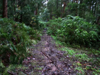
These pix were taken in the Olinda Forest, Dandenong Ranges National Park, on June 18 2012, 35 km east of central Melbourne.


They show the scenery, environment and flora on a 3 km circuit hike starting at the Olinda Creek Rd, along Barges Track, Bartlett Track and return on the Olinda Creek Rd.


Many colorful winter Fungi were on display, on a very cold and overcast day!

See my animated Slideshow of the visit!

North Warrandyte - Yarra River Hike


These pix were taken on June 19 2012 on the North Warrandyte Walking Track, in the Warrandyte State Park, 20 km east of central Melbourne.


This unsigned track is not shown in Melways or in Parks Vic maps, and links Koornong Crescent with Osborne Rd, reached from a turnoff off the Warrandyte to Research Rd.


See my animated Slideshow of the visit!
 

Sunday, June 17, 2012

O'Shannassy Aqueduct Trail - Warburton - Yuonga Rd to Mt Donna Buang Rd section


These pix were taken on June 16 2012, on a 3 km (return) hike along the O'Shannassy Aqueduct Trail,  from the Yuonga Rd carpark to the Mt Donna Buang Rd.


See the Slideshow of all of the photos, with music, of my visit!

Wednesday, June 13, 2012

Mt St Leonard in winter


These pix were taken on June 12 2012 at Mt St Leonard, 70 km east of Melbourne, overlooking the town of Healesville.

They show the scenery and environment on a 3 km return hike to the summit, from Monda Rd, with spectacular panoramas across the Yarra Valley to Melbourne and beyond.

Some images have been included of the large communications towers on the summit.
|
It is not commonly known, but in 1945 the Australian Army carried out experimental test transmissions from the summit to assess high frequency radio coverage, using the No.10 wireless set.

Sadly, much of the surrounding forest is being decimated by logging activity.

See a Slideshow with text and music, of my visit

Sunday, June 10, 2012

Silvan Forest in early winter


These pix were taken on June 9 2012 in the Silvan Forest, 40 km east of central Melbourne.


They show the scenery and fauna on a 3 km circuit hike, along the Olinda Creek Track, Messmate Track, and Boundary Track, starting opposite the main entrance of the Silvan Reservoir Park, on Stonyford Rd.


The winter Fingi have appeared in copious numbers!

See all of the Photos of my visit as a Slideshow!

Saturday, June 09, 2012

Predator Track Hike - Dandenong Ranges National Park

Predator Track

Pix taken on June 8 2012 in the Olinda Section of the Dandenong Ranges National Park, 35 km east of central Melbourne.

Very old tree on Bartlett Track

My hike was a circuit, starting at gated Bartlett Track, at the junction with Falls Rd, then along Predator Track to Mathias Track.

Predator Track

Then back along Falls Rd to home base, about 3 km.

Bartlett Track

It was misty rain for most of the journey, and very dark in the forest!

See a Slideshow of my visit!

Wednesday, June 06, 2012

Blackburn Lake Sanctuary

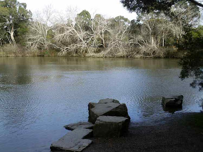
On June 5 2012 I visited the Blackburn Lake Sanctuary, 18 km east of central Melbourne.


Occupying about 30 hectares  it is a bushland haven for wildlife and is managed by the Whitehorse City Council, with strong support from local Volunteer organizations.

The Lake is actually Melbourne Water's Blackburn Retarding Basin and the Sanctuary is popular with hikers, cyclists, field naturalists, birdwatchers, and school groups.


The history of the Lake dates back to 1889 when the Kooyongkoot Creek was dammed. It was a popular destination for visitors in the early 1900s who travelled to nearby Blackburn Railway Station, then walked to the Lake for picnics and boating.


My visit was mainly a 3 km hike around the Lake and along adjacent trails.


Information boards provide details of the history of the Sanctuary, and the trails are well signposted.

Many kookaburras, galahs, and cockatoos live in the trees!

See my Slideshow, with music, of my visit, which has all of the pictures.


Friday, June 01, 2012

Witton's Bushland Reserve - Warrandyte State Park


I visited Witton's Bushland Reserve on May 30 2012, which is adjacent to the Yarra River, in the Warrandyte State Park, some 40 km east of central Melhourne.


I did a 3 km hike in the area, along the river and then on to the firetrack around the creek, joining Reserve Rd, then back to the picnic area.


The river was in flood mode, with lots of debris passing the canoe launching ramp, which was under water.

See my Audio/visual Slideshow of the visit!


Tuesday, May 22, 2012

Sherbrooke Falls in late Autumn


These pix were taken on May 22 2012 in the Sherbrooke Forest, Dandenong Ranges National Park, 40 km east of central Melbourne.


They show the scenery and environment on the 3 km (return) Sherbrooke Track, and the Falls.


This was a very overcast day, almost dark in the forest, not good for photography!

See all of the Photos of my visit in the Slide Show (below) - requires Flash!


Wednesday, May 16, 2012

Exploring the Woodduck Track, Kurth Kiln Regional Park


These pix were taken on a 2 km circuit hike along the Woodduck Track, Kurth Kiln Track, and Beenak Rd, in the Kurth Kiln Regional Park, 60 km east of Melbourne, May 15 2012.

The route was muddy, and passed through forest, with many colorful Banksia flowers in bloom.

See all of the Photos of my visit!

Monday, May 07, 2012

O'Shannassy Aqueduct Trail - Dee Bridge Sector


These pix were taken on May 6 2012.


They show the O'Shannassy Aqueduct Trail, between the Dee Rd carpark and the Dee Trestle Bridge, 80 km east of Melbourne, on a 3 km return hike.


The day was very overcast and bleak!

See the full set of Photos of my visit!

Wednesday, May 02, 2012

Olinda Forest in late autumn

Pix taken on April 30 2012 in the Olinda Forest, 40 km east of central Melbourne.

They show the scenery and environment on a 3 km circuit hike along the Olinda Creek Walking Track, starting at the junction of gated Management Rd 13 and the Olinda Creek Rd.

Some colorful autumn fungi had appeared!

See the complete set of Photos!