Rotating Headlines
Join this Weblog!
To become a Follower of this Weblog.
Click on the "Follow" link, underneath the list of current followers. You will be taken to an information panel where you may enter your personal details and other information. When completed, the title of this Weblog will appear in the Reading List on your Blogger Dashboard, and your Profile Picture will be displayed next to other Followers!
Followers to my Weblog!
Showing posts with label boating. Show all posts
Friday, February 10, 2012
Cannon's Creek Coastal Park - Rutherford Inlet - Westernport Bay
My visit of February 8, 2012.
Cannon's Creek is a coastal village on northern Westernport Bay, classified as an International Conservation Zone, 65 km SE of Melbourne.
It is located on the Rutherford Inlet, with extensive mangroves and millions of crabs!
The main walking track, 2 km return, includes a boardwalk and lookout, with splendid views across the estuary towards the settlement of Warneet.
See all of the Photos of my visit, and check out my YouTube video!
Friday, January 27, 2012
Yarra River Reserve, Warrandyte - action on Australia Day 2012!
These pix were taken on January 26, 2012, Australia Day, in the Yarra River Reserve, Warrandyte, 15 km east of central Melbourne.
Plenty of action on a hot day!
See all of the Photos of my visit, and check out my YouTube video!
Plenty of action on a hot day!
See all of the Photos of my visit, and check out my YouTube video!
Exploring the Werribee South Beach
These pix were taken on January 25, at the Werribee South Beach, 35 km by road south west from central Melbourne.
They shows the scenery, boat launching ramps, the small beach, the mouth of the Werribee River, and the resident pelicans!
A walking trail extends easterly from the beach towards the site of a vast new high-density housing development.
It is proposed to build a new bridge over the river, to take bike and foot traffic to the western bank, which is at the southern extremity of the recently opened Werribee River Regional Park.
See all of the Photos of my visit, and check out my YouTube video!
Monday, January 23, 2012
Very low tide at Balnarring Beach, Westernport Bay
These pix were taken at Balnarring Beach, on Westernport Bay, 80 km south of Melbourne, on January 22, 2012.
There was an extraordinarily low tide, exposing magnificent reefs and rockpools.
My visit was a 4 km return baach-hike, to the adjacent beach of Merricks.
There was plenty of action, with many visitors exploring the rockpools!
A strange Sea Beast emerged from the ocean, wearing a large hat!
Wednesday, January 18, 2012
Honeysuckle Point - Shoreham Coast
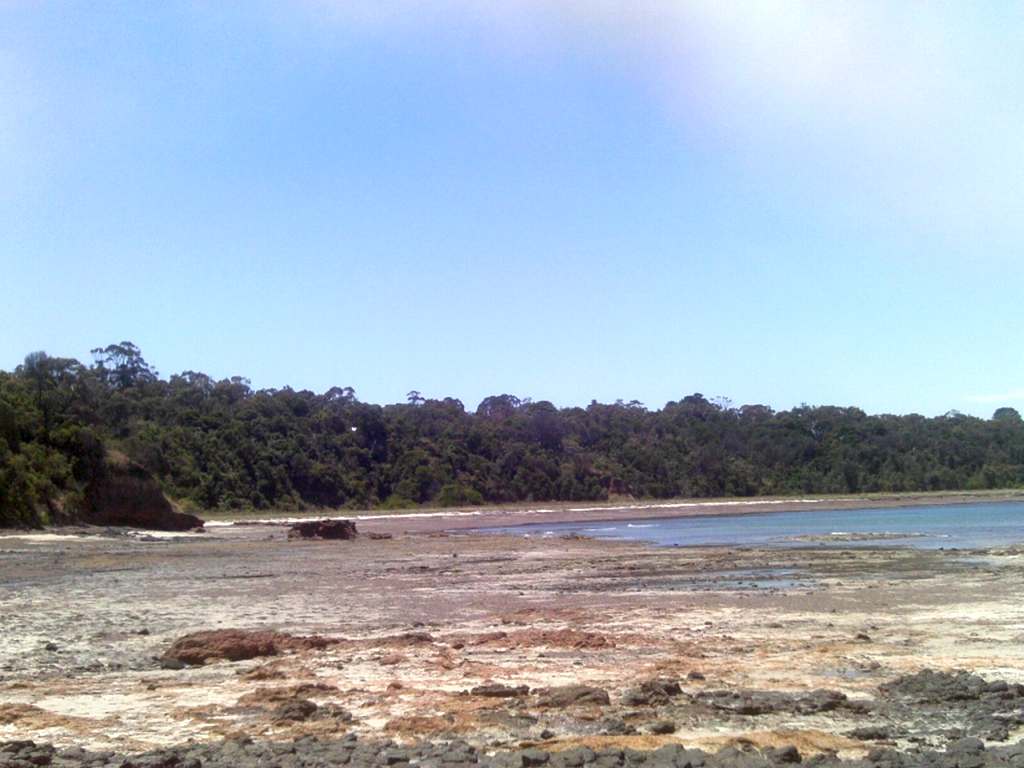
These pix were taken on January 16, 2012, on a 4 km return beachwalk along the Shoreham Coast, 8 km south of Melbourne, on Westernport Bay.
The tide was out a long way, exposing beautiful rock pools and serene lagoons.
My hike started at the main car park, then along the beach to Honeysuckle Point and the magnificent reef.
I first visited Shoreham Beach on January 16 1952, exactly 60 years ago, when I attended a ten-day camp organized by the YMCA at Camp Buxton.
I have included a photo taken on that day, showing members of my family and my tent mates - I am at the left in a blue and yellow striped T-shirt and runners! This is a tinted photo which I created from the original scanned 620 size black and white print.
For a full account of my 1952 visit to YMCA Camp Buxton, with some additional photos, please see my Shoreham Pictorial Heritage Website,
See all of the Photos of my visit - check out my YouTube video!
![]() | ||||
| Colorized photo of January 16, 1952! I am at left! |

Thursday, December 29, 2011
Boating at Tulum Beach (Balnarring)
YouTube Video above!
Watch the YouTube video (above) and see all of the Photos of my visit!
Monday, April 06, 2009
Exploring Warneet, Westernport Coast


Warneet is a village about 50km southeast of Melbourne. on the north of Westernport Bay.
With a population of around 460, Warneet is one of the smaller towns in Australia, and is at an altitude of about 9m above sea level.
It's popular for fishing and boating, and is located on the Rutherford Inlet. On the opposite bank is the village of Cannon's Creek.
Several interesting walking tracks start at the South Jetty, around the inlet and through extensive mangrove wetlands.
I visited Warneet on April 5, 2009, and explored the Main Walking Track (from South Jetty to North Jetty), and the interesting Mangroves Walking Track, a total distance of about 4 km.
See the full set of Photos of my visit
Sunday, March 01, 2009
Cannon's Creek Coastal Reserve

Cannon's Creek is a coastal village on northern Westernport Bay, classified as an International Conservation Zone, 65 km SE of Melbourne.
It is located on the Rutherford Inlet, reached from the South Gippsland Highway, then along the Tooradin-Baxter Rd, then into Cannon's Creek Rd, to a small car park at the main jetty.
There are extensive mangroves and millions of crabs!
The Foreshore Reserve includes the main 2 km walking track, a boardwalk and lookout, with splendid views across the estuary towards the settlement of Warneet.
There are three jetties, reconstructed in 2008 by a cooperative effort between the Shire of Casey and local community groups.
A large sign at the car park describes the development, fauna, flora and features of the Reserve.
I visited the Reserve on February 28, 2009.
See the full set of Photos of my trip!
Subscribe to:
Comments (Atom)


